



Why does the best-known Buddhist site in Nepal sit inside a landscape that archaeologists have barely opened? Most visitors to Lumbini see the Maya Devi Temple, the Ashoka Pillar, the marker stone, and the monastic zone built under the Kenzo Tange master plan. Almost nobody sees the rest. Within about 40 kilometers of that temple lie a ruined city, a sealed relic mound, several Ashokan pillar sites, and dozens of brick structures that have never been excavated. Lumbini archaeology is not a finished story. It is an active, contested, and badly underfunded field, and this article explains what is known, what is still buried, and why the difference matters.
What Lumbini Actually Is
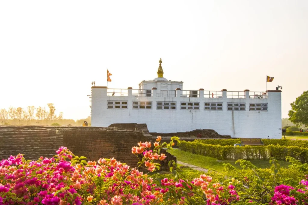
Lumbini is the place Buddhist tradition identifies as the birthplace of Siddhartha Gautama. UNESCO inscribed it on the World Heritage List in 1997, after two earlier attempts failed. Inscription covers the Sacred Garden: the Maya Devi Temple, the Ashoka Pillar erected in the third century BCE, the marker stone, the pond, and the surrounding monastic remains.
Outside that boundary, the archaeology continues for kilometers in every direction. Nepal’s Department of Archaeology and the Lumbini Development Trust group these sites under the heading of the Greater Lumbini Area. Rupandehi, Kapilvastu, and Nawalparasi districts all contain part of it.


One point is worth settling early. Lumbini is not a single monument. It is the surviving core of a region that was urbanized, politically organized, and densely built long before the modern Terai landscape of paddy fields and highway towns took shape.
The 2013 Excavation That Changed the Dating Argument
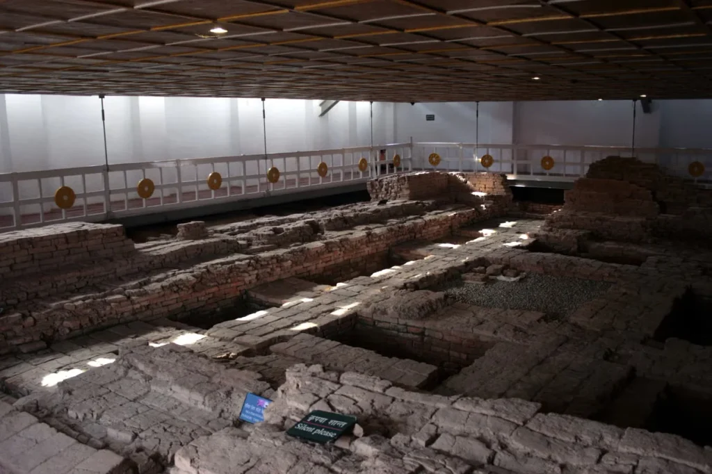
In 2013, a team working under the Maya Devi Temple reported something unexpected. Beneath the brick structures associated with the Mauryan emperor Ashoka, excavators found postholes outlining a timber railing around an open space, with clay floors and the mineralized roots of a tree at the center.
Dating came from two methods: radiocarbon dating of charcoal recovered from the postholes, and optically stimulated luminescence dating of the surrounding soil. Those results pointed to the sixth century BCE. Robin Coningham of Durham University, who directed the work with Nepali colleagues, described it at the time as the earliest Buddhist shrine yet identified.
Why that matters: the historical date of the Buddha’s life has never been settled. Scholarly estimates range across roughly two centuries. A shrine at Lumbini in the sixth century BCE does not prove any particular birth date, and the excavators did not claim it did. What it does show is that the site was already being treated as significant well before Ashoka monumentalized it. Readers should hold the finding and its limits together. A single stratigraphic sequence at one location is evidence, not consensus.
Tilaurakot: A City Mapped, Mostly Not Dug
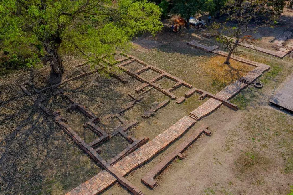
About 27 kilometers west of Lumbini, near Taulihawa in Kapilvastu district, sits Tilaurakot. Many archaeologists identify it as Kapilavastu, the Shakya capital where Siddhartha grew up. India promotes two alternative candidates, Piprahwa and Ganwaria, just across the border. Neither identification is universally accepted, and the dispute is political as well as academic.
What is not disputed is the scale of what is there. Geophysical survey, which maps buried structures by measuring magnetic and electrical properties of the soil without digging, has produced a remarkably complete plan of the buried city. According to the Durham University project that has worked there since 2014 with Nepal’s Department of Archaeology and the Lumbini Development Trust, the survey revealed:
- A fortified citadel roughly 500 by 400 meters, with gateways aligned to the cardinal directions.
- A grid plan of houses, shops, streets, and lanes, described by the project as the most complete plan of an Early Historic South Asian city.
- A central walled complex of about 100 by 100 meters, probably administrative or palatial.
- A monumental brick-lined water tank about 30 meters on each side, built in the third century BCE.
- A large monastic complex to the east, plus further structures south and west.
- Monastic remains, an industrial zone, and suburbs beyond the walls.
Here is the gap. Excavation at Tilaurakot has touched a northern gate, the water tank, and deposits beside the Samai Mai Temple. Nearly everything else on that map, including the eastern monastic complex, is known only as a magnetic anomaly. Occupation at the Samai Mai area began in the eighth century BCE, with fortification and the grid layout following in the sixth century BCE. Abandonment of the core came in the first half of the first millennium CE.
In 2015, excavators recovered 494 punch-marked coins from an earthen pot at the site. Small finds like that are useful for dating trade and currency, but they are not a substitute for opening the monastic structures.
Why It Is Still Not Excavated
Three reasons come up repeatedly in the professional literature and in conversations with Nepali archaeologists.
Excavation destroys what it reveals
Digging is irreversible. Once a trench removes a stratigraphic sequence, that sequence is gone. Modern practice favors non-invasive survey first and targeted excavation second, especially where conservation funding for exposed brickwork is uncertain. Exposed ancient brick in the Terai, with its monsoon rainfall and seasonal waterlogging, degrades fast.
Money and capacity
Nepal’s Department of Archaeology operates on a modest budget across the whole country, from Kathmandu Valley temples to Himalayan cave sites. Large open-area excavation in the Terai, with the conservation commitment that follows, competes against earthquake recovery work and other priorities.
The heritage politics of the border
A joint Nepal and India nomination covering Tilaurakot, Piprahwa, and Ganwaria has been suggested by Nepali specialists including Gopi Krishna Sharma. That approach would sidestep the identification dispute. It would also require diplomatic agreement that does not currently exist.
Tilaurakot and the World Heritage Process
Tilaurakot entered UNESCO’s Tentative List in 1996. Nepal revived the nomination in 2023 and submitted a dossier on January 31, 2025.
At its 47th session in Paris, from July 6 to 16, 2025, the World Heritage Committee deferred the proposal on the recommendation of ICOMOS, its advisory body for cultural heritage. Himal Upreti, chief archaeology officer of the Lumbini Development Trust, told the Kathmandu Post that the team failed to address some key ICOMOS recommendations. No member state proposed a supporting amendment on Nepal’s behalf.
Tilaurakot was not discussed at the committee’s 48th session in Busan in 2026, because Nepal submitted no formal nomination that year. Officials have indicated a plan to resubmit in 2027.
Lumbini’s Own Conservation Pressures
Inscribed status is not permanent safety. Lumbini has avoided the List of World Heritage in Danger in 2024, 2025, and 2026, but the committee has repeatedly said risks are not fully resolved.
A UNESCO and ICOMOS Reactive Monitoring Mission visited from February 4 to 7, 2026. Following it, the committee issued 13 recommendations. They included stronger protection of archaeological remains in the Sacred Garden, archaeological risk mapping in future planning, a long-term conservation strategy for the Maya Devi Temple, and a Heritage Impact Assessment before a proposed World Bank development project proceeds. A review of the Kenzo Tange master plan was also requested, along with better safeguarding of intangible Buddhist heritage and stronger controls on air and noise pollution. Nepal must submit a new State of Conservation report by February 1, 2027.
Read against the Tilaurakot deferral, a pattern emerges. The constraint on Lumbini archaeology is rarely the absence of remains. It is management capacity, documentation, and the ability to demonstrate that what is uncovered can be protected afterward.
The Wider Map: Sites Beyond Lumbini and Tilaurakot
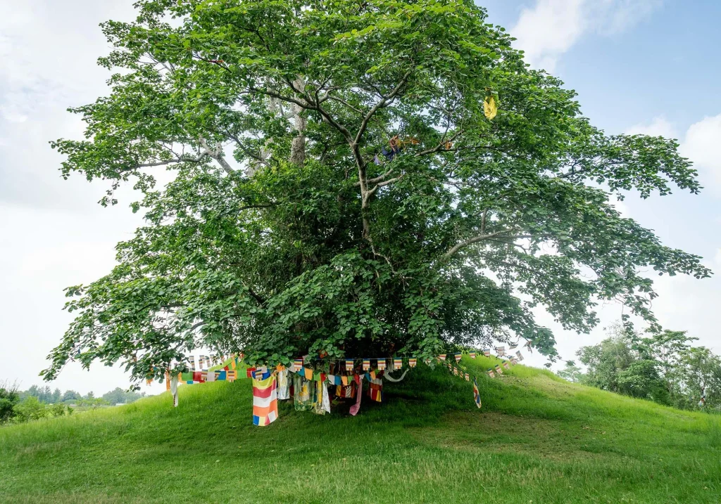
Several other locations in the Greater Lumbini Area carry Buddhist associations and archaeological remains. Research intensity varies enormously between them.
| Site | District | Known for | Excavation status |
|---|---|---|---|
| Lumbini Sacred Garden | Rupandehi | Birthplace tradition, Ashoka Pillar, Maya Devi Temple | Excavated; inscribed 1997 |
| Tilaurakot | Kapilvastu | Candidate for ancient Kapilavastu; grid-planned citadel | Extensively surveyed, limited excavation |
| Ramagrama | Nawalparasi | Relic stupa tradition; mound never opened | Deliberately unexcavated at the core |
| Gotihawa | Kapilvastu | Ashokan pillar stump and stupa remains | Partially excavated |
| Niglihawa | Kapilvastu | Ashokan pillar with inscription | Partially investigated |
| Kudan | Kapilvastu | Monastic and stupa remains | Partially excavated |
| Devdaha | Rupandehi | Associated with Maya Devi’s maternal home | Limited investigation |
Ramagrama deserves a note of its own. Buddhist tradition holds that it is the one relic stupa of the original eight that was never opened and redistributed. If that tradition is accurate, the mound still contains its original deposit. Archaeologists have surveyed and worked around the edges, but the core has not been excavated, and there is a strong argument for leaving it that way. Not every question needs to be answered with a trench.
What This Means If You Visit
Most organized tours give Lumbini half a day. That is enough for the Sacred Garden and a walk through the monastic zone, and it is why the rest of the region stays empty.
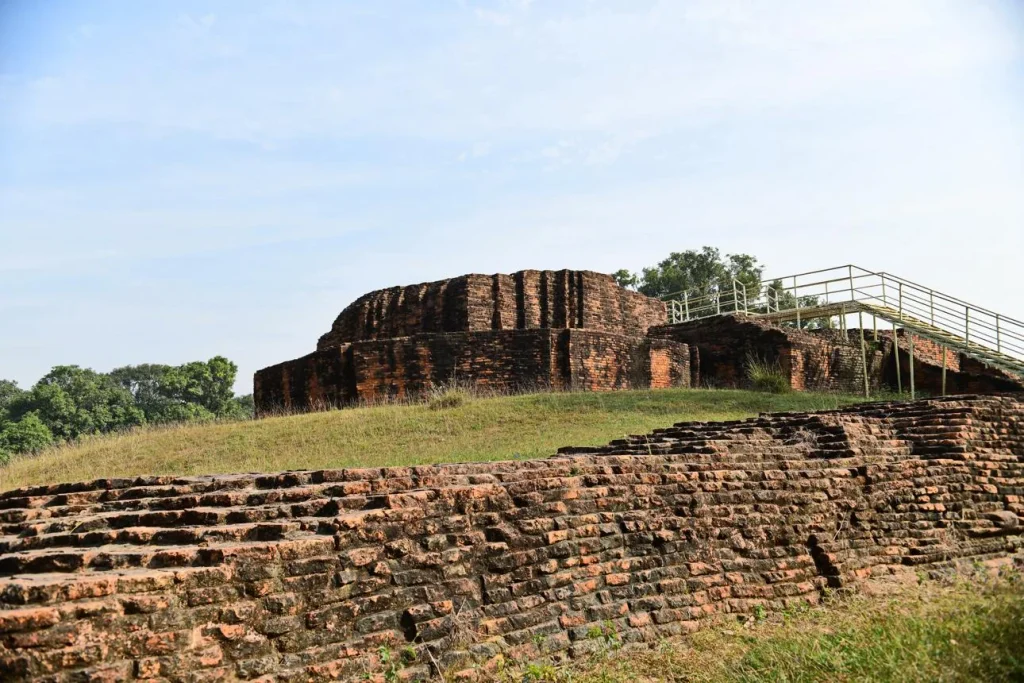
Tilaurakot is reachable from Lumbini by road in roughly an hour, depending on conditions. The site is open, quiet, and almost entirely unreconstructed, which is precisely its interest. You are looking at low brick foundations in grass, not a restored monument. Bring the plan in your head, because the interpretation on site is limited.
Go with realistic expectations. These are working archaeological landscapes in farming districts, not visitor attractions with infrastructure. Local communities in Kapilvastu and Nawalparasi live alongside them. Treat active trenches, protective sheds, and fenced mounds as off limits, and do not climb structures.
If you are planning a wider route through the region, our Lumbini travel guide covers access and logistics, and our overview of UNESCO World Heritage Sites in Nepal sets Lumbini alongside the country’s other inscribed properties. For what fills a day inside the Sacred Garden itself, see our list of things to do in Lumbini. Readers interested in how Buddhist architecture developed elsewhere in Nepal may want our piece on Boudhanath Stupa, and those traveling in the western Terai can read about Tharu festivals in the Terai, since the people living around these sites are not incidental to them.
What Remains Genuinely Unknown
Honest summary of the open questions:
- Whether Tilaurakot is ancient Kapilavastu. Evidence is strong but not decisive, and Indian scholarship favors other candidates.
- The historical dates of the Buddha’s life. The 2013 Lumbini sequence narrows some possibilities without settling the question.
- What the eastern monastic complex at Tilaurakot contains. It has been mapped, not opened.
- How far the Greater Lumbini settlement network extended. Survey coverage is uneven across the three districts.
- Whether Ramagrama’s core deposit is intact. Tradition says yes. Nobody has tested it, and there are good reasons not to.
Specialists disagree about several of these, and a reader should be suspicious of any account that presents them as resolved.
Frequently Asked Questions
Is Lumbini the confirmed birthplace of the Buddha?
Lumbini is identified as the birthplace by Buddhist tradition and by the Ashokan pillar inscription of the third century BCE, which records Ashoka’s visit and the reason for it. That is strong early documentation. Archaeology confirms sustained religious use of the spot from at least the sixth century BCE, which is consistent with the tradition without independently proving the biographical claim.
How old is the Maya Devi Temple?
The visible structure is modern, built over much earlier remains. Below it lie Mauryan-period brick structures associated with Ashoka, and below those, the timber shrine sequence dated to the sixth century BCE by the 2013 excavation.
Can visitors see active excavations?
Not usually. Fieldwork runs in defined seasons and trenches are backfilled or covered afterward. At Lumbini and Tilaurakot you are generally looking at consolidated or re-covered remains rather than open work.
Why is Tilaurakot not a World Heritage Site?
Its nomination was deferred at the World Heritage Committee’s 47th session in July 2025, on the recommendation of ICOMOS. It remains on the Tentative List, where it has been since 1996, and Nepali officials have signaled a plan to resubmit in 2027.
How far is Tilaurakot from Lumbini?
Roughly 27 kilometers west, near Taulihawa in Kapilvastu district. Road travel generally takes about an hour, though conditions vary by season.
Is the Ramagrama stupa really unopened?
Buddhist tradition holds that it is the only one of the eight original relic stupas never opened and redistributed. Archaeological work has been limited to the surrounding area rather than the core, so the tradition has not been tested. Many specialists consider leaving it untested the right decision.
Is Lumbini at risk of losing World Heritage status?
It has not been placed on the List of World Heritage in Danger, and avoided it in 2024, 2025, and 2026. The committee has issued repeated recommendations on conservation and management, and Nepal must report again by February 1, 2027. Danger listing is a warning mechanism rather than removal from the list, which is very rare.
What is the best time of year to visit the Greater Lumbini Area?
October through March is generally the most comfortable period in the western Terai. Pre-monsoon months are very hot on the plains, and monsoon rainfall makes rural approach roads to the outlying sites difficult.
Before You Go
Lumbini rewards slow travel more than most places in Nepal, because the interesting part is spread across three districts rather than concentrated at one gate. Give it two days rather than an afternoon, and spend one of them west of the Sacred Garden.
If this was useful, save it for your trip planning and share it with someone heading to the Terai. NepalVue publishes regularly on Nepal’s archaeology, heritage, and regions beyond the standard circuit, and there is plenty more to explore.
Sources and further reading: Durham University’s Tilaurakot-Kapilavastu project and UNESCO’s World Heritage listing for Lumbini.


