



Most accounts of Nepali rivers begin with hydropower potential. Start instead with what is already there, and the Karnali looks like something rarer than a reservoir site: a large Himalayan river that still runs from glacier to plain without a single major dam across its main stem. That status is not permanent. A 900 MW project on the upper river has moved from paperwork into construction tendering, and a string of other schemes sit in the survey queue. In this article we explain what a free-flowing river actually means in hydrological terms, what the Karnali carries besides water, who depends on it, and what the evidence says about what changes when a river like this is interrupted.
What “free-flowing” means, and why the Karnali qualifies
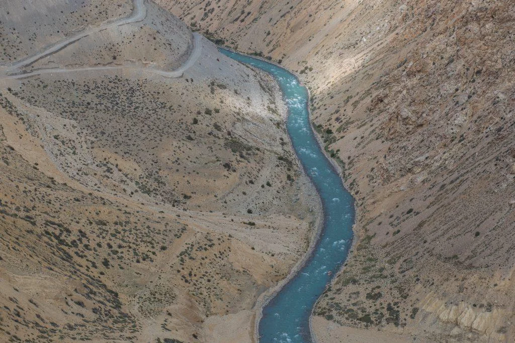
A free-flowing river is not simply a river without a dam. Hydrologists use the term for a system where four kinds of connection remain largely intact: along the channel from source to mouth, across the floodplain during floods, downward into groundwater, and through time as seasonal flows rise and fall. Break any one of those, and the river starts behaving differently even where the water still looks the same.
Nepal’s Karnali keeps most of those connections. It rises at the Mapchachungo Glacier in Tibet at roughly 3,962 m and runs about 1,080 km in total, of which some 507 km lie inside Nepal, making it the country’s longest river, according to compiled basin figures. Its catchment covers around 127,950 km², with roughly 45 percent on the Indian side. Mean discharge within Nepal is on the order of 1,369 m³/s, rising to about 2,990 m³/s where the river, known downstream as the Ghaghara, joins the Ganges at Revelganj in Bihar.


Two large tributaries define its shape. Seti drains the western catchment and joins near Doti. Bheri drains the east and meets the main stem near Kuineghat in Surkhet.
The sediment question most dam debates skip
Water is the obvious cargo. Sediment is the one that builds land.
Himalayan rivers carry extraordinary loads of sand, silt and boulders scoured from young, soft rock. That material builds the gravel bars where gharial bask, the islands where grassland regenerates, and ultimately the agricultural soils of the Terai and the northern Gangetic plain. A barrier on the main stem traps a portion of it upstream. Downstream, the river compensates by cutting into its own bed and banks, a process engineers call hungry water. How much sediment any specific structure would trap on the Karnali is a modeled estimate, not a measured one, and the numbers vary with design. Treat any single figure with caution.
What the river supports
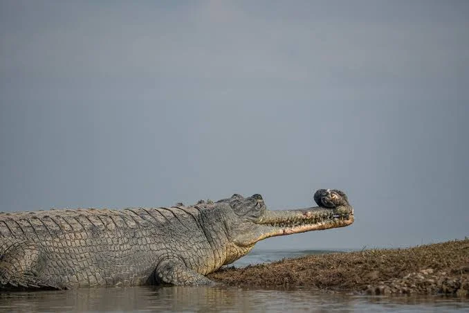
Gharial, dolphins and the shrinking Geruwa
Lower Karnali and its distributaries form one of Nepal’s few remaining habitats for the Ganges river dolphin, a freshwater cetacean that navigates by echolocation in turbid water. Numbers there are now very small. Bardiya National Park reported three dolphins in the Karnali in late 2025, against five recorded in a 2016 government survey, as covered by the Kathmandu Post. A separate count on the Mohana river in Kailali found 54. Park officials attribute the Karnali decline mainly to falling water levels in the Geruwa, the river’s eastern distributary, along with habitat loss.
Caution is warranted on these figures. Dolphin surveys in shallow, braided channels are difficult, counts vary with method and season, and a drop from five to three in a population this small is not statistically robust on its own. What is clear is direction, not precision: the Karnali’s dolphins are few and the eastern channel is drying.
Gharial, the narrow-snouted fish-eating crocodilian listed as Critically Endangered by the IUCN, also use the Karnali system, including stretches outside protected area boundaries. Research published in 2026 in Ecology and Evolution examined gharial population, reproduction and seasonal movement in the Karnali and its tributaries, which matters because conservation planning in Nepal has historically concentrated on river reaches inside park boundaries.
Fish that have to move
Golden mahseer and several Himalayan carp species migrate seasonally between lowland feeding reaches and upstream spawning grounds. Dams and barrages block that movement unless passage structures work, and fish passes designed for temperate salmonids often fail for South Asian species with different swimming behavior. An Asian Development Bank review of dam impacts on fish in Nepal’s rivers examined exactly this problem. Evidence on what works in Nepali conditions remains thin, which is itself a finding worth stating plainly.
People of the Karnali basin
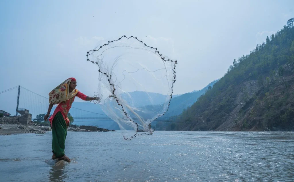
Describing the basin as wilderness would be wrong. Communities along the Karnali include Thakuri, Chhetri, Dalit and Magar households in the mid-hills of Karnali Province, Tharu communities across the lower floodplain in Bardiya and Kailali, and Bhotiya and other Himalayan communities in the upper catchment around Humla and Mugu. Livelihoods, land tenure and relationships with the river differ sharply between these groups, and so do the stakes in any dam decision.
Traditions vary by community and region. Some communities hold specific river confluences as sacred sites; others relate to the river primarily through fishing, irrigation, ferry crossings and seasonal grazing on floodplain grassland. Generalizing a single “river culture” across a basin this large would flatten real differences.
Electricity access in Karnali Province remains low. The Provincial Planning Commission reports that 33.39 percent of the population, about 561,000 people, has direct electricity access, with 135,000 of 309,376 households connected to the national grid and roughly 30,000 households on micro-hydro, as reported by the Kathmandu Post in March 2026. That context matters: the communities nearest the country’s largest untapped hydropower resource are among the least served by it.
The projects on the drawing board
Karnali Province has an estimated hydropower potential of around 18,000 MW across the Karnali, Tila and Bheri rivers, based on feasibility studies. Current generation in the province is roughly 10 MW.
| Project | Capacity | Location | Status (2026) |
|---|---|---|---|
| Upper Karnali | 900 MW | Achham and Dailekh, Karnali main stem | Developer GMR; construction tenders issued July 2025; financing still unresolved |
| Betan Karnali | Reported as 688 MW and 439 MW in different figures | Achham and Surkhet | Power purchase agreement in final stage |
| Phukot Karnali | 480 MW | Kalikot | Delayed by legal disputes over share allocation |
| Nalagad (reservoir) | 410 MW (417 MW also cited) | Jajarkot, Nalagad tributary | Stalled for lack of investment |
| Jagdulla (semi-reservoir) | 106 MW | Dolpa, Jagdulla River | Contract signed; construction not begun; target July 2030 |
Upper Karnali has the longest history. Announced in 2006 at 300 MW, raised to 900 MW in a 2009 application, it reached a Project Development Agreement with the Investment Board Nepal on 19 September 2014. Financial closure deadlines were extended repeatedly, challenged in the Supreme Court in 2022, and resolved by a constitutional bench ruling in May 2023 that favored the developer while barring further extensions. Tenders for an access road tunnel, a bridge over the Karnali and about 7 km of headworks roads went out on 8 July 2025, with an estimated cost of Rs 146 billion, according to the Kathmandu Post.
Export plans have shifted. Of the 900 MW, 500 MW was intended for Bangladesh under a power supply agreement initialed on 5 December 2024, but Bangladesh has since canceled it. Another 292 MW was planned for India and 108 MW for domestic use. Those allocations should be treated as subject to change.
Run-of-river does not mean no effect
Upper Karnali is described as a run-of-river scheme, which many readers take to mean the river continues unchanged. It does not quite work that way. A run-of-river design still involves a barrier, in this case a gravity dam reported at 64 m high with a small impoundment, and it typically diverts water through a tunnel to a powerhouse downstream, leaving a dewatered reach in between. Length of that reach, the minimum flow released into it, and the daily pattern of releases determine most of the ecological outcome. Those details sit in project documents rather than headlines, and they deserve more public scrutiny than the headline megawatt figure.
Rafting, tourism and the economics of an intact river
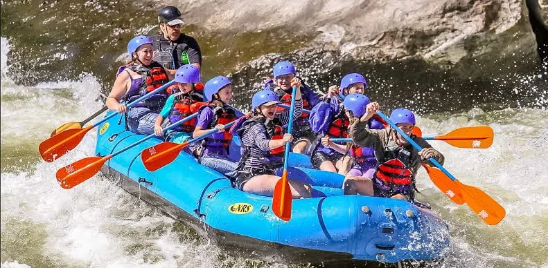
Karnali’s multi-day whitewater run is widely regarded among river guides as the most demanding commercial expedition in Nepal, typically launching near Dungeswar and finishing close to Chisapani over several days. Revenue from that activity is small compared with hydropower, and nobody serious argues that rafting alone justifies leaving a river undammed. What river tourism does provide is a measurable, locally distributed income stream that depends on flow patterns continuing as they are, which is rarely counted in project appraisals. If you want context on how river tourism works elsewhere in the country, our guide to white water rafting in Nepal covers the main commercial rivers.
Bardia National Park sits on the lower river and depends on it. Visitors heading there can read our Bardia National Park safari guide for practical detail. For the wider region’s cultural calendar, see our piece on Gaura Parva in Sudurpashchim and Karnali, and for the high country at the top of the basin, our Upper Dolpo trek guide.
How to read the argument honestly
Two things are true at once, and most coverage picks one.
Nepal has a real energy problem, a real trade deficit in fuel, and a province where two thirds of people lack direct grid electricity. Hydropower is the resource it has. At the same time, the Karnali is the last large Nepali river whose longitudinal connectivity has not been broken, it supports species with nowhere else to go, and the sediment it delivers builds land far beyond Nepal’s borders. Neither fact cancels the other.
Where the science is genuinely unsettled, say so. Sediment trapping estimates, downstream channel response, and the effectiveness of fish passage in Himalayan rivers are all modeled or poorly tested rather than measured on this river. Anyone presenting those numbers as settled is overclaiming, in either direction.
Frequently asked questions
Is the Karnali really Nepal’s last undammed major river?
It is the last large Nepali river without a major dam or barrage across its main stem inside Nepal. Smaller structures, irrigation intakes and tributary projects exist within the basin, and barrage infrastructure exists downstream in India, so “undammed” describes the main stem in Nepal rather than the whole system.
How long is the Karnali?
About 1,080 km in total from source to its confluence with the Ganges, of which roughly 507 km are in Nepal. That makes it Nepal’s longest river.
Will Upper Karnali definitely be built?
Construction tendering began in July 2025, but financial closure has not been completed and the project has slipped repeatedly since 2006. Reported export arrangements have also changed, with Bangladesh canceling its planned purchase. Treat completion as likely-but-unconfirmed rather than certain.
How many Ganges river dolphins are left in the Karnali?
Bardiya National Park reported three in late 2025, down from five in a 2016 government survey. Counts in small populations carry wide uncertainty, so the trend matters more than the exact number.
What is the difference between a run-of-river and a reservoir project?
Reservoir projects store large volumes of water and can release it on demand. Run-of-river schemes store little or none and generate from current flow, but they still involve a barrier and often divert water through a tunnel, leaving a reduced-flow reach between the intake and the powerhouse.
Can you raft the Karnali?
Yes. Multi-day expeditions run commercially, usually in the post-monsoon and spring seasons. It is a remote, logistically demanding trip rather than a beginner’s day out, and access involves a long road journey in western Nepal.
Who lives in the Karnali basin?
Many communities, with different languages and livelihoods. These include Thakuri, Chhetri, Dalit and Magar households in the mid-hills, Tharu communities across the lower floodplain, and Bhotiya and other Himalayan communities in Humla, Mugu and Dolpa. Practices and priorities vary by community and district.
Would damming the Karnali affect India?
Changes to flow timing and sediment delivery would propagate downstream into Uttar Pradesh and Bihar, where the river is known as the Ghaghara and is the Ganges’ largest tributary by volume. Scale of that effect depends on project design and operating rules, and credible estimates remain modeled rather than observed.
Before you go
Rivers are easiest to value once they are gone, which is a poor time to start. If you are planning travel in western Nepal, or simply want to follow how this decision unfolds, save this guide and share it with someone heading that way. Follow NepalVue for more reporting on Nepal’s landscapes, wildlife and the choices being made about both.
External references used in this article: Kathmandu Post on the Upper Karnali project timeline and the Asian Development Bank review of dam impacts on fish in Nepal’s rivers.


