



Nepal’s most consequential medieval kingdom was not in the Kathmandu Valley. For roughly two centuries, power in the western Himalaya ran out of Sinja, a narrow valley in what is now Jumla District, and its reach extended across the Karnali basin into western Tibet. Almost nothing about the Khasa kingdom is widely taught, and its archaeology sits several days’ travel from any tourist route. This article sets out what the inscriptions and excavations actually show, what is argued over, and why the site matters beyond regional pride.
Where this happened
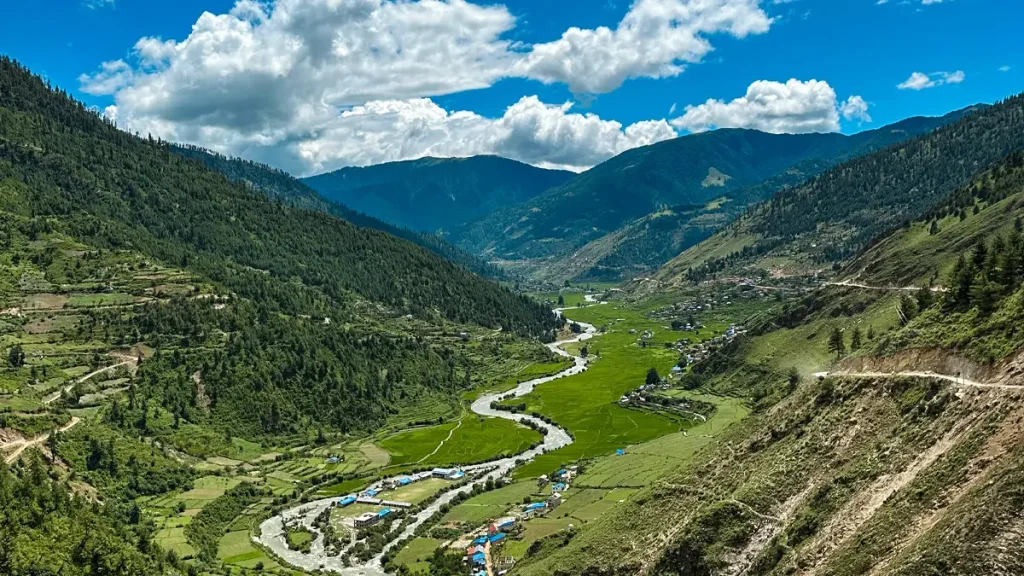
Sinja Valley lies in Jumla District, Karnali Province, in Nepal’s mid-western mountains, at roughly 29°19′N, 81°58′E. Access is by air to Jumla and then overland, and conditions depend heavily on season. Karnali remains one of the least visited provinces in the country.
Geography explains the kingdom better than any dynastic list. Sinja sits on the routes connecting the Gangetic plains to western Tibet. Control of those corridors meant control of trade in salt, wool, grain and borax, and a polity sitting on them could tax a great deal of movement without governing much territory directly.


UNESCO’s tentative list entry for the site, submitted by Nepal’s Department of Archaeology, suggests further research could situate Sinja within the ancient Uttar Pata route linking the plains to western Tibet and onward trade networks. That framing is a research proposal rather than a demonstrated fact, and it is worth repeating as such.
The dynasty, as the inscriptions record it
Khasa Malla history is reconstructed mainly from inscriptions, several of them found far outside Nepal. That is a strength and a limitation: inscriptions are contemporary evidence, but they are also royal self-presentation, and they survive unevenly.
Tradition credits the founding to Nagaraja, said to have come from Khari Pradesh, in the Ngari region of western Tibet, and to have established his seat at Sinja. Dates for him vary between the eleventh and early twelfth centuries, and no inscription of his survives.
Krachalla is the earliest ruler with a surviving inscription: a copper plate dated 1223 CE, held at the Baleshwar temple at Sui in Kumaon, in present-day India. He described himself as a devout Buddhist.
Ashoka Challa, who followed, issued copper plates at Bodhgaya in Bihar dated 1255 and 1278. In them he used the title Khasha-Rajadhiraja, emperor of the Khasas. A western Himalayan king endowing a major Buddhist site on the Indian plains tells you something about both his resources and his religious alignment.
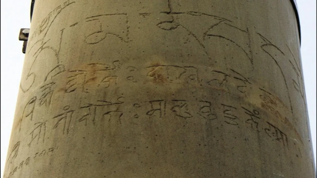
Ripu Malla left perhaps the most striking trace. In 1312 CE he had an inscription cut into Ashokan pillars at Lumbini and Nigali Sagar, more than a thousand years after Ashoka raised them. It is a dual-script text: a Tibetan Buddhist mantra above, a Sanskrit blessing in Devanagari below.
Prithvi Malla is generally treated as the dynasty’s most prominent ruler. His pillar inscription at Dullu, dated 1357 CE, lists his predecessors and records that Nagaraja founded the line six generations before Krachalla. A gold inscription from Jumla dated 1356 CE names both Buddhist and Hindu deities. At its height the kingdom’s influence is described as reaching Guge and Purang in western Tibet, Dullu to the southwest, and Kaskikot in the east.
| Ruler | Date (CE) | Location | Notes |
|---|---|---|---|
| Krachalla | 1223 | Baleshwar temple, Sui, Kumaon | Copper plate in Sanskrit; earliest surviving royal inscription of the line |
| Ashoka Challa | 1255 and 1278 | Bodhgaya, Bihar | Copper plates; uses the title Khasha-Rajadhiraja |
| Ripu Malla | 1312 | Lumbini and Nigali Sagar | Cut into Ashokan pillars; Tibetan mantra above, Devanagari Sanskrit below |
| Prithvi Malla | 1356 | Jumla | Gold inscription naming Buddhist and Hindu deities |
| Prithvi Malla | 1357 | Dullu | Stone pillar listing dynastic predecessors |
Note what that table shows about the kingdom’s footprint. Its surviving royal texts are spread across Kumaon, Bihar, Lumbini, Jumla and Dullu. Few medieval Himalayan polities left evidence across such a spread.
What excavation has found at Sinja
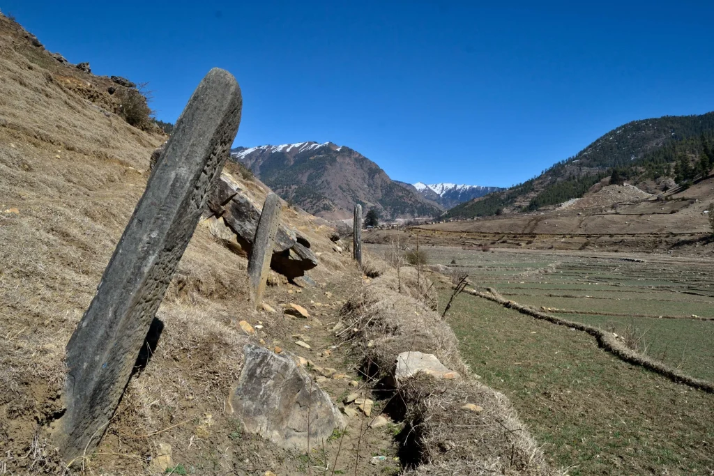
Archaeological work at Sinja has been conducted by Nepal’s Department of Archaeology, with involvement reported from Cambridge University. Published accounts, including the UNESCO tentative list entry, describe remains of palaces, temples and settlement.
Several specific features recur in those accounts:
- A ring of large monolithic stone columns surrounding the settlement area.
- A Malla gateway approached by steps.
- Earthen pipes indicating an organized water supply system.
- Excavated temple sites, including Kanak Sundari and Tripura Sundari.
- Caves across the Hima River containing votive Buddhist chaityas, with inscriptions on the adjacent cliffs.
A piped water system is the detail worth pausing on. Monumental stonework signals ambition; plumbing signals administration. Together they describe a planned capital rather than a fortified camp.
Readers should know that detailed excavation reports from Sinja are not easily accessible internationally, and much of what circulates online repeats the same short summaries. Site condition is described as good in the UNESCO entry, which dates from 2008. Current conservation status in 2026 is not something this article can verify.
Where the script argument sits
3and at nearby Dullu are repeatedly cited as among the earliest surviving examples of Devanagari script in the region, dated to the thirteenth century, alongside finds from Surkhet and Dailekh. From that follows a much larger and much louder claim: that Sinja is the birthplace of the Nepali language.
Handle that claim carefully. What the evidence supports is that early written forms of Khas, the ancestor of modern Nepali, are attested in this region from the thirteenth and fourteenth centuries. A written attestation is not a birthplace. Languages are spoken across wide areas long before anyone writes them down, and the surviving record reflects where royal patrons commissioned stone carving, not where speech originated.
Strong regional feeling attaches to this point, which is understandable given how little attention Karnali has received from national historiography. Accuracy serves that case better than overstatement.
Religion in the kingdom, and what persists
Khasa Malla religious history is not a simple story of one faith. Early rulers present themselves as Buddhist, Krachalla explicitly so, and Ashoka Challa’s endowments at Bodhgaya sit squarely in that tradition. Hindu emphasis grows across the fourteenth century, and Prithvi Malla’s inscriptions, naming both Buddhist and Hindu deities, read as a transitional moment rather than a break.
Underneath both runs Masto worship, a set of shamanic practices associated with territorial deities across the Karnali region. Masto traditions are not a historical residue. They continue in Jumla and neighboring districts, and the UNESCO entry notes that Masto rites are still performed at some of the stone temples known locally as Dewals.
Practice varies considerably between villages and between communities, and outsiders should not assume a single Karnali tradition. Where observance is restricted or private, that restriction is the community’s to set.
How the kingdom ended
Khasa Malla power fragmented during the fourteenth century. Out of it emerged the Baise Rajya, the twenty-two principalities of the Karnali and Bheri region, and the Chaubisi Rajya, the twenty-four principalities of the Gandaki region. Those states persisted until the Gorkha conquests unified Nepal in the later eighteenth century.
Causes are debated. The historian Ludwig Stiller attributed fragmentation in part to Rajput migration into the hills following the siege of Chittorgarh in 1303, which introduced new ruling lineages. Other accounts emphasize the inherently feudatory structure of the kingdom, whose principalities were largely self-governing even at its height. Sources also differ on dating the collapse, with some placing the decisive break in the late thirteenth century and others in the fourteenth.
No single explanation is established. Readers encountering a confident account of why Khasa fell should check what evidence it rests on.
Visiting Jumla and the Sinja Valley
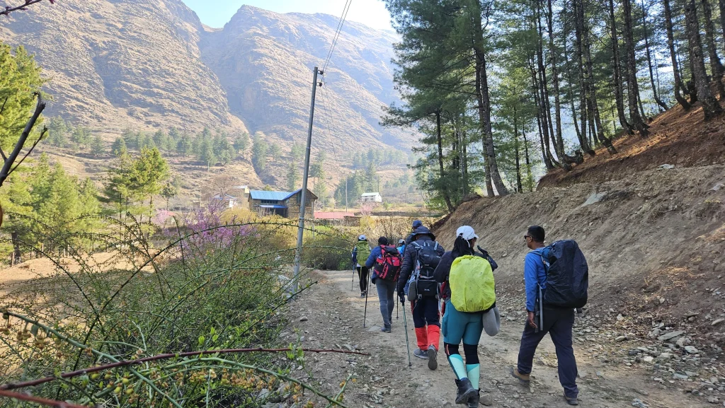
Practical realities first. Jumla is reached by flight from Nepalgunj or Surkhet, with onward road or trail travel to Sinja. Flights are weather dependent, road conditions vary sharply by season, and winter brings snow at these elevations. Facilities are basic, and travel here is not comparable to the Annapurna or Everest regions.
Visitors should also be clear about what the site is. Sinja is an archaeological landscape with low standing remains, not a monumental ruin. Its interest is historical and requires some preparation to appreciate. Carved stone at the site is archaeological material under Nepali law, and should be neither moved nor collected.
Jumla is more often visited en route to Rara Lake, and combining the two makes practical sense. Our guide to Rara Lake covers that region, and Upper Dolpo describes the neighboring district for anyone planning a longer route through the far west. For living tradition in the Karnali and Sudurpashchim region, see Gaura Parva, and for context on Nepal’s inscribed heritage, our overview of UNESCO World Heritage Sites in Nepal.
Frequently asked questions
What was the Khasa kingdom?
A medieval Himalayan kingdom centered on Sinja in present-day Jumla District, prominent from roughly the twelfth to the fourteenth centuries. At its height its influence reached western Tibet, Kumaon and the central Nepali hills.
Where is the Sinja Valley?
In Jumla District, Karnali Province, western Nepal, at approximately 29°19′N, 81°58′E. Access is by flight to Jumla and then overland.
Is Sinja a UNESCO World Heritage Site?
Not yet. It was added to UNESCO’s tentative list on 30 January 2008 under cultural criteria (ii) and (iii), submitted by Nepal’s Department of Archaeology. A tentative listing is a candidacy, not an inscription.
What do the Khasa inscriptions say?
They record royal endowments, titles and lineages. Krachalla’s 1223 plate and Ashoka Challa’s Bodhgaya plates of 1255 and 1278 are religious grants. Prithvi Malla’s 1357 Dullu pillar lists his dynastic predecessors.
Did the Nepali language originate in Sinja?
That claim is frequently made but overstated. Early written forms of Khas, ancestral to Nepali, are attested in this region from the thirteenth century. Written attestation shows where a language was recorded, not where it began.
Were the Khasa kings Buddhist or Hindu?
Both, at different points. Early rulers present as Buddhist, Hindu emphasis grows through the fourteenth century, and Masto shamanic traditions ran alongside throughout. Prithvi Malla’s inscriptions name deities from both traditions.
Why did the kingdom break up?
No single cause is established. Explanations include its feudatory structure, in which principalities were largely independent, and Rajput migration into the hills after 1303. Sources also disagree on when the collapse began.
Can you visit the archaeological sites?
Yes, with effort. Travel to Jumla is by flight and is weather dependent, facilities are limited, and remains are low rather than monumental. Carved stone at the site is protected archaeological material.
NepalVue covers the parts of the country that rarely reach the itineraries, Karnali among them. If this was useful, save it for later, share it with someone who would want it, and follow NepalVue for more.


