



How much of the Buddha’s world is still underground? Most visitors to Lumbini see the Maya Devi Temple, the Ashokan pillar and the sacred pond, then leave. Those occupy a few hectares. Spread across the western Terai around them sits a cluster of related sites, some partly dug, many identified only by instruments reading what lies beneath the soil, and at least one that has just been refused World Heritage status. Lumbini archaeology is substantially a story about what has not been excavated, and about why that matters now rather than later.
What Lumbini is, precisely
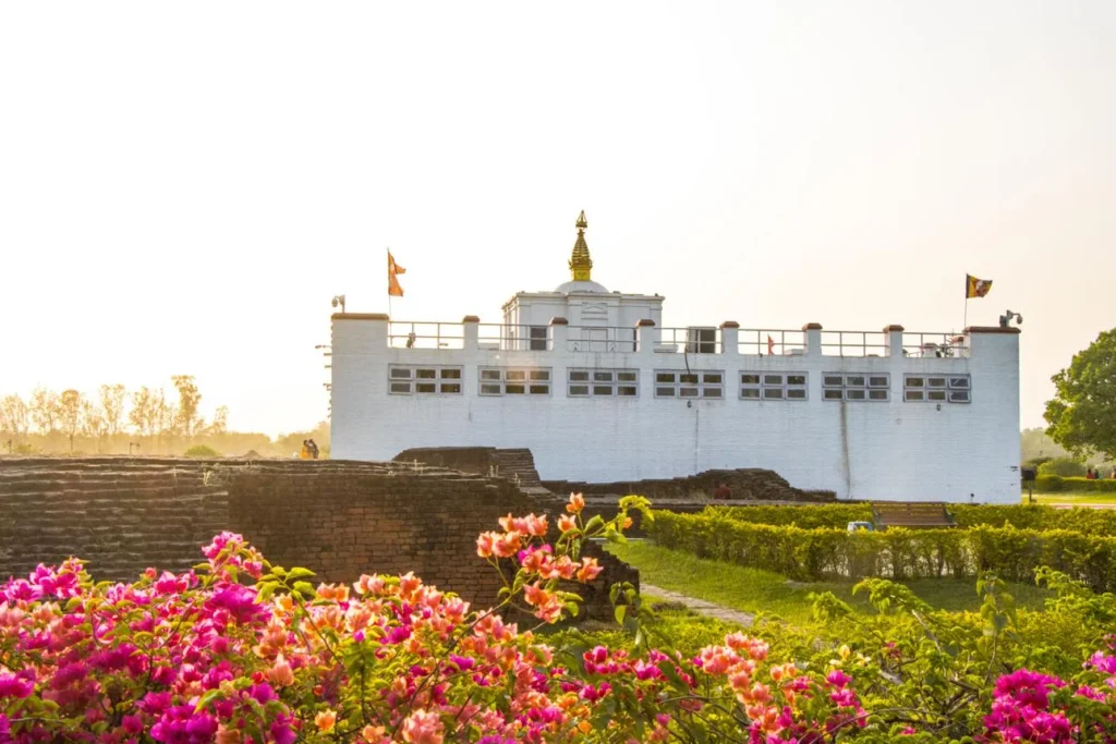
Lumbini in Rupandehi district is the recorded birthplace of Siddhartha Gautama, and it has been a UNESCO World Heritage Site since 1997.
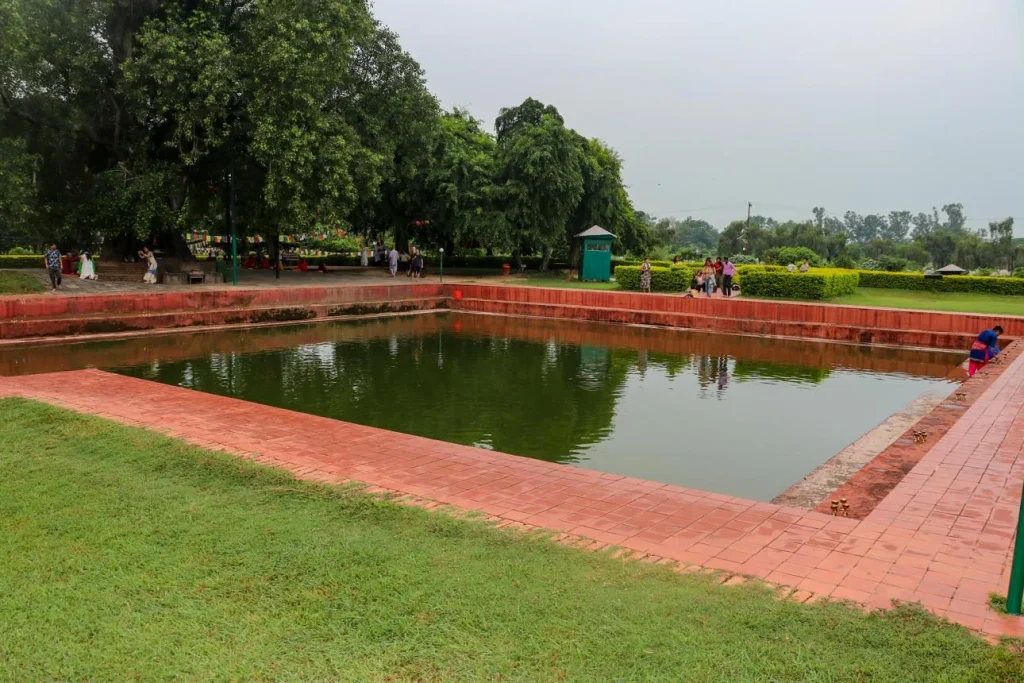
Its anchor is a sandstone pillar erected by the Mauryan emperor Ashoka in the third century BCE, carrying an inscription marking the spot. Around it are the Maya Devi Temple, the Puskarini pond, and the brick remains of monasteries and stupas built over many centuries.


Beyond that core lies a monastic zone of modern temples built by Buddhist communities from many countries, laid out under a master plan designed in the late 1970s. Walking it, you could reasonably conclude the archaeology is finished.
It is not. Lumbini sits inside a wider landscape that archaeologists call the Greater Lumbini Area, running west and north across Rupandehi and Kapilvastu districts, and containing the settlements and monasteries that gave the birthplace its context.
Tilaurakot, and what geophysics revealed
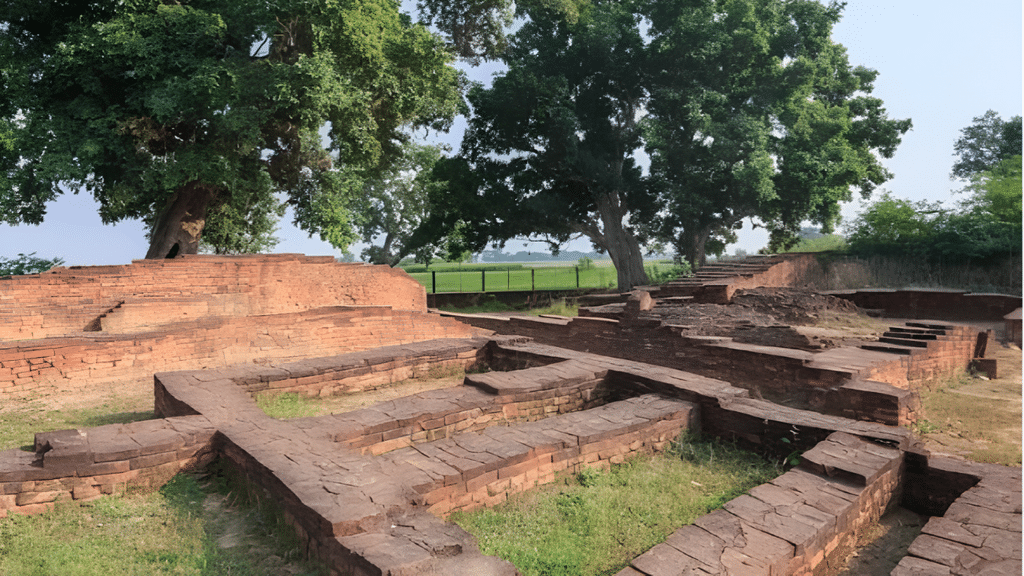
Roughly 25 kilometers west of Lumbini, about 3 kilometers north of Taulihawa, Tilaurakot sits on the eastern bank of the Banganga river. It is identified by Nepali and international archaeologists as ancient Kapilavastu, the Shakya capital where Siddhartha lived before leaving to seek enlightenment.
Durham University, working with Nepal’s Department of Archaeology, the Lumbini Development Trust and Nepal’s National Museum, has investigated it since 2014 under the UNESCO Chair held by Robin Coningham, with funding including UNESCO’s Japanese Funds-in-Trust and the National Geographic Society.
Methods matter here. Rather than digging first, the team combined geophysical survey, UAV mapping, auger coring, fieldwalking and geoarchaeology, with excavation used selectively to test what the instruments found.
What emerged is a city plan. Geophysics revealed a grid of houses, shops, streets and lanes inside a fortified citadel of roughly 500 by 400 meters, with cardinally oriented gateways. Durham describes the result as the most complete plan of an Early Historic South Asian city.
| Feature | Dimension or date | How established |
|---|---|---|
| Fortified citadel | About 500 x 400 m | Geophysical survey |
| Central walled complex | About 100 x 100 m | Geophysical survey |
| Monumental tank | About 30 m square, brick-lined | Dated to the 3rd century BCE |
| Earliest occupation near Samai Mai Temple | 8th century BCE | Excavation, over 4 m of deposits |
| Fortification of the settlement | 6th century BCE | Excavation |
| Abandonment of the city core | First half of the 1st millennium CE | Excavation |
Those dates carry weight. Occupation beginning in the eighth century BCE and fortification in the sixth century BCE place a substantial walled settlement here in the period traditionally associated with the Buddha’s lifetime.-
The part still in the ground
Here is the finding this article is named for. Geophysics at Tilaurakot has identified a large monastic complex to the east of the city, plus further structures to the south and west, outside the walls. Hinterland work has located additional monastic complexes, an industrial zone and suburbs.
None of that has been excavated. These are anomalies in instrument data, interpreted as buildings, and until someone digs they remain interpretations.
What they establish even so is the shape of the problem. Around a city whose plan is now broadly known sits a ring of structures nobody has opened, in farmland, outside any protective boundary.
The other sites in the cluster
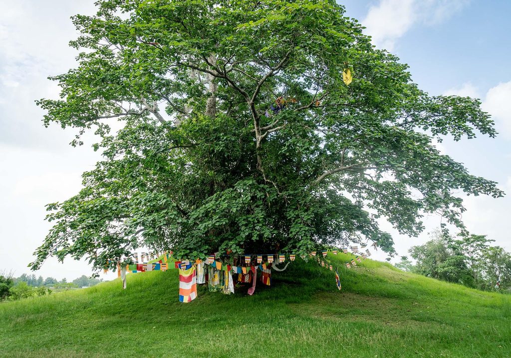
The Greater Lumbini Area contains several locations connected to the Buddha’s life and to early Buddhist practice, among them Kudan, Gotihawa, Niglihawa, Sagarhawa and Ramagrama. Each has been investigated to differing and generally limited degrees.
Ramagrama in Nawalparasi carries particular significance, being traditionally held to be the only stupa containing relics of the Buddha that has never been opened. It survives as an earthen mound.
Stating a caution plainly: identification of several of these sites with specific episodes in the Buddha’s life rests on a combination of textual tradition, the accounts of Chinese pilgrims, and archaeology, and the weight of each varies by site. Where tradition and excavation have not been reconciled, that is worth knowing rather than glossing.
The 2025 World Heritage decision
Nepal nominated Tilaurakot for the World Heritage List, submitting its dossier on 31 January 2025. Preparation was led by the Australian heritage expert Duncan Marshall, with support from Robin Coningham, Kai Weise, Yukio Nishimura, Yani Joshi and Basanta Bidari. The site had been on UNESCO’s tentative list since 1996, with the nomination revived in 2023.
At the 47th session of the World Heritage Committee in Paris, held from 6 to 16 July 2025, the bid was deferred rather than approved.
Several reasons were reported. ICOMOS, UNESCO’s advisory body, recommended deferral and raised issues that officials said Nepal had not fully addressed. Nepal’s diplomatic effort was described as weak: no member state proposed a supporting amendment, while India’s Maratha Military Landscapes, also recommended for deferral, was approved after Japan submitted one.
There is a disputed-identification dimension too. India has not accepted Tilaurakot as the definitive ancient Kapilavastu, promoting Piprahwa and Ganwaria in Uttar Pradesh instead. A joint trans-boundary nomination with India was raised afterwards as an approach that might have helped.
Named voices in the aftermath included Sanuraja Shakya, member secretary of the Lumbini Development Trust, who criticized Nepal’s diplomatic engagement; Himal Upreti, its chief archaeology officer, who said the ICOMOS concerns needed coordinated state-level engagement; Gopi Krishna Sharma, who raised India’s reservations; and the senior archaeologist Basanta Bidari, who argued that science and history support Nepal’s case and that persistence will be required.
Deferral is not rejection. It means the committee wants more work before deciding, and Nepal can return. What it also means is that the protective and funding advantages of inscription are not yet in place for a site with unexcavated monastic complexes sitting in open farmland.
Why unexcavated is not the same as safe
Leaving archaeology in the ground is sometimes the right call. Excavation is destructive, and material left undisturbed stays available for better techniques later.
That argument holds when the ground is protected. Around Tilaurakot it is agricultural land, and ploughing, levelling, irrigation works, brick manufacture and road building all reach deeper than people assume. Durham’s own project page states that the site needs protection from future development.
Two pressures compound it. Lumbini’s visitor economy is growing, with associated construction. And a site identified only on a geophysics plot has no legal status, because protection attaches to recognized monuments, not to anomalies in survey data.
Which produces an awkward sequence: survey finds a monastery, the find is published, legal protection does not follow automatically, and the field above it is still a field.
What a visitor can actually see
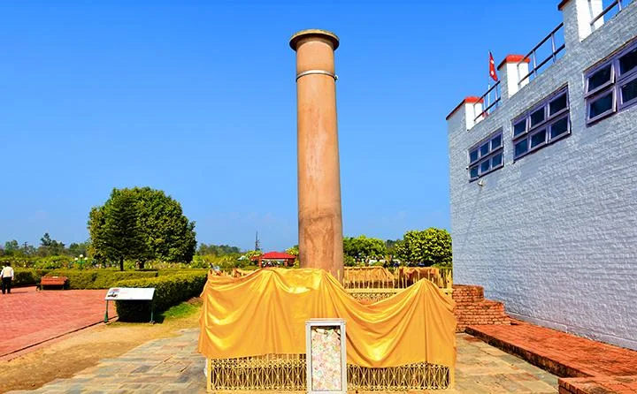
At Lumbini itself, the Maya Devi Temple shelters the marker stone and the excavated brick structures beneath, with the Ashokan pillar and Puskarini pond immediately outside. Surrounding monastery zone temples are modern and built by Buddhist communities from many countries.
Tilaurakot is a day trip west and is a different experience: low brick foundations, gateways, a surrounding wall line and open ground, with the interpretation largely invisible because it lies below. Going without reading first means seeing bricks in a field.
Rupandehi and Kapilvastu are ordinary working districts rather than a heritage park, and the communities farming this land live alongside the sites. Our Lumbini travel guide covers logistics, and our overview of Nepal’s UNESCO World Heritage Sites places it among the country’s other inscribed properties. For context on how the Buddha is represented across Asia, see our piece on why Buddha images differ by country, and for the wider culture of this region our coverage of Tharu festivals in the Terai.
Where the evidence runs out
Three honest limits.
The identification of Tilaurakot as Kapilavastu is accepted by Nepali and Durham-led research and contested by Indian scholarship favoring Piprahwa. Archaeology has not settled it, and the dispute is partly political.
Geophysical anomalies are not buildings until excavated. Describing the eastern monastic complex as a monastery is an interpretation of instrument data, and a well-founded one, and still an interpretation.
Dates for the Buddha’s lifetime are themselves debated among scholars, with proposed ranges differing by more than a century. Archaeological dates from Tilaurakot are independent of that debate and do not resolve it.
Frequently asked questions
Is there more to Lumbini than the Maya Devi Temple?
Considerably more. The temple area is the core of a World Heritage Site, and the Greater Lumbini Area extends across Rupandehi and Kapilvastu districts, including Tilaurakot, Kudan, Gotihawa, Niglihawa, Sagarhawa and Ramagrama.
What is Tilaurakot?
A fortified early historic city about 25 kilometers west of Lumbini, identified by Nepali and Durham-led research as ancient Kapilavastu, the Shakya capital. Geophysical survey has revealed a grid of streets, houses and shops within walls of roughly 500 by 400 meters.
How old is the settlement at Tilaurakot?
Excavation near the Samai Mai Temple found occupation beginning in the eighth century BCE, with the settlement fortified in the sixth century BCE and a brick-lined tank dated to the third century BCE.
What has been found but not excavated?
Geophysics has identified a large monastic complex east of the city and further structures to the south and west, plus monastic complexes, an industrial zone and suburbs in the hinterland. All remain uninvestigated by excavation.
Why did Tilaurakot fail to get World Heritage status?
Its nomination was deferred at the 47th World Heritage Committee session in July 2025. ICOMOS recommended deferral over unresolved issues, no member state proposed a supporting amendment, and India’s competing identification of Kapilavastu with Piprahwa is considered a complicating factor.
Is Ramagrama really unopened?
It is traditionally held to be the only Buddha relic stupa never opened, and it survives as an earthen mound. That status rests substantially on textual tradition rather than on excavation, which is consistent with the claim itself.
Can visitors see the unexcavated sites?
You can visit the locations, and there is little to see, since the structures are below ground and identified by survey. Tilaurakot’s excavated foundations, gateways and wall line are visible and reward reading about beforehand.
Is the archaeology at risk?
Unexcavated remains around Tilaurakot sit in agricultural land outside protected boundaries, and the Durham project states the site needs protection from future development. Legal protection generally attaches to recognized monuments rather than to features identified only by geophysics.
Further reading
The excavation and survey work is summarized on Durham University’s Tilaurakot project page, and the 2025 nomination outcome was reported by the Kathmandu Post.
NepalVue follows Nepal’s heritage as live research rather than settled sightseeing. Save this one before a Lumbini trip, share it with anyone who thinks the site is just the temple, and follow NepalVue for more from the western Terai.


