



Nepal in July is usually described as one uniformly soaked country. Measurements say something stranger. A ridge above Pokhara collects more than 5,000 mm of rain a year, while a valley floor roughly 40 km to the north, beyond the Annapurna wall, stays under 200 mm. Same country, same storm season, a twenty-fold difference. That contrast is not an accident of local weather. It is a textbook case of orographic rainfall: mountains forcing wet air upward until it can no longer hold its moisture. This article explains the mechanism, the data behind it, where Nepal’s wettest and driest pockets sit, and what recent measurements suggest is changing.
What the monsoon actually is
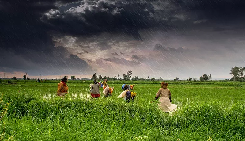
The South Asian summer monsoon is a seasonal reversal of wind. Through June to September, land across the subcontinent heats faster than the Indian Ocean. Air rises over that warm land, and moist air flows in from the sea to replace it. Nepal sits at the northern limit of that flow, with a 2,000 km wall of rock in the way.
Nepal’s Department of Hydrology and Meteorology (DHM) puts the normal monsoon onset at 13 June and the normal withdrawal at 2 October. Those dates shift every year. In 2025 the monsoon arrived in eastern Nepal on 29 May, about 15 days early, and left the country on 10 October. In 2026 the withdrawal again ran late: by 3 October the system had only begun retreating from Sudurpaschim, Karnali, western Lumbini and parts of western Gandaki.


Four months carry most of the year’s water. Research by Ramchandra Karki and colleagues, published in the journal Climate in 2017, found the monsoon supplies roughly 80% of Nepal’s annual precipitation. Pre-monsoon adds about 12.5%, post-monsoon about 4%, and winter about 3.5%. Agriculture, hydropower and drinking water all depend on that single four-month window.
The mechanism: why a mountain makes rain
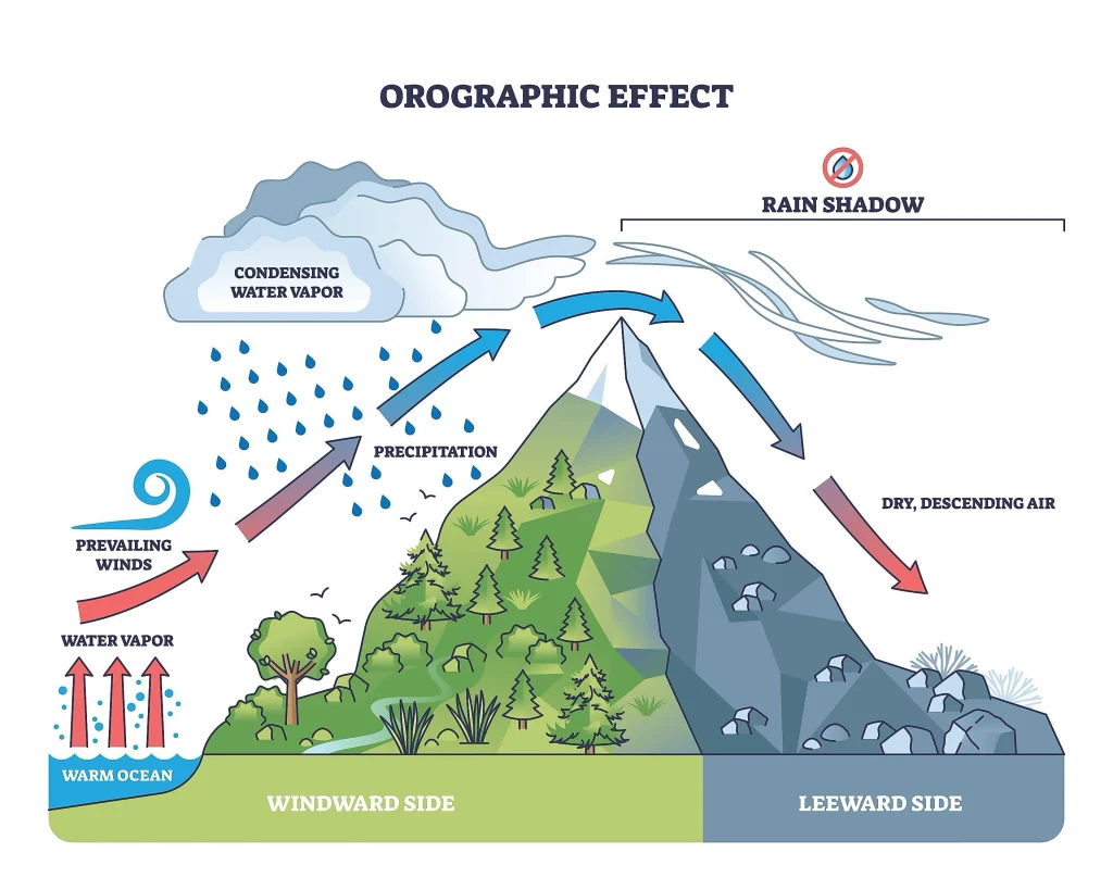
Air arriving from the Bay of Bengal is warm and close to saturation. When the terrain rises, that air has nowhere to go but up. Rising air expands, and expanding air cools. Cooler air holds less water vapor, so the surplus condenses into cloud and falls as rain. Meteorologists call it orographic precipitation, and it is the single most important control on where water lands in Nepal.
Two details make the Nepali case extreme.
- Relief. Nepal compresses an elevation range from about 60 m in the Terai to 8,849 m at Sagarmatha into roughly 200 km of north-south distance. Few places on Earth force air upward so fast.
- Barrier completeness. Once air has dumped its moisture climbing the first ranges, almost nothing is left for the valleys behind them. A leeward dry zone forms, commonly called a rain shadow.
Satellite work by Bodo Bookhagen and Douglas Burbank, published in Geophysical Research Letters in 2006, mapped this in detail along the Himalayan front. Their analysis of radar rainfall data identified bands of heavy rainfall tied to the first steep rise of topography rather than to the highest summits. Peak rainfall tends to sit well below the crest line, on the outer ridges, which is precisely where Nepal’s wettest stations are found.
Nepal’s wettest places
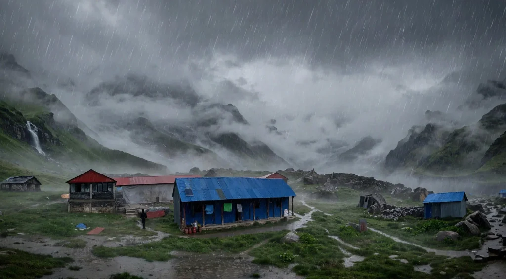
Lumle, a ridge settlement at roughly 1,700 m northwest of Pokhara, is the standard example. Karki and colleagues record annual rainfall there above 5,000 mm. Lumle faces south into the monsoon flow with the Annapurna massif directly behind it, so incoming air is lifted abruptly and repeatedly.
Pokhara itself, lower and slightly further from the wall, is Nepal’s wettest major city. Gumthang and Num, in the central and eastern hills, exceed 3,500 mm annually. DHM’s 2025 seasonal monsoon report listed Lumle again as the highest seasonal total in the country.
Note what these places share. None of them is high. All of them sit where the land first steepens.
Nepal’s driest places
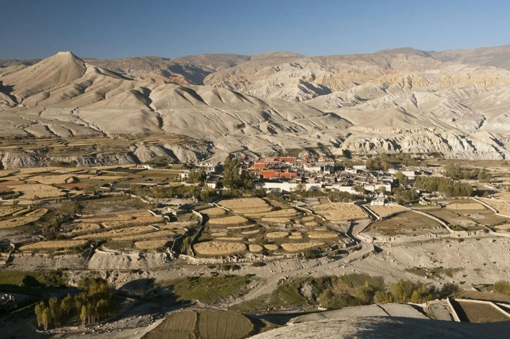
Behind the barrier, the picture inverts. Mustang, Manang and Dolpa lie north of the Annapurna and Dhaulagiri ranges. Karki and colleagues record under 200 mm of annual rainfall across these districts, and under 150 mm during the monsoon itself. For comparison, that is drier than much of the Sahel.
Kali Gandaki offers the sharpest single transect anywhere in Nepal. Walk north from Beni through Tatopani and Lete, and the hillsides shift from dense broadleaf forest to pine, then to juniper scrub, then to bare rock and wind-polished cliff within about 60 km. Thakali and Lobas communities farming in that upper valley have never relied on monsoon rain. Their fields depend on channeled snowmelt and glacier-fed streams instead.
| Location | Approx. elevation | Position relative to range | Approx. annual rainfall |
|---|---|---|---|
| Terai plains | 60 to 200 m | In front of the hills | 1,500 to 2,000 mm |
| Lumle ridge | ~1,700 m | First steep rise, windward | Above 5,000 mm |
| Annapurna crest | 7,000 to 8,000 m | Barrier | Mostly snow, poorly gauged |
| Jomsom, Mustang | ~2,700 m | Leeward, rain shadow | Historically under 300 mm |
| Upper Mustang | 3,500 to 3,900 m | Deep leeward | Historically under 200 mm |
Figures above are drawn from Karki and colleagues (2017) and from DHM station reporting. Gauge coverage above 3,000 m is thin, and high-altitude snowfall is systematically undermeasured, so treat the barrier row as an acknowledged gap rather than a number.
Why the rain falls at night
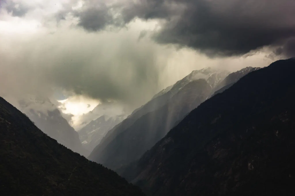
One pattern surprises most visitors. Monsoon rain in the hills often arrives after dark, in heavy bursts, then clears by mid-morning. That timing is not random.
During the day, slopes heat and drive air upward along the valley walls. Clouds build through the afternoon. After sunset, those slopes cool faster than the valley air, and dense cold air drains downhill. Converging downslope flows meet in the valley bottom and force the moist layer upward again, triggering a second burst of convection overnight. Research by Hatsuki Fujinami and colleagues, published in the Journal of Geophysical Research: Atmospheres in 2021, documented this twice-daily precipitation maximum in the Himalayas and linked it to land surface effects.
Practically, this is why trekking in monsoon is less hopeless than it sounds. Our guide to Nepal’s monsoon season covers how walkers plan around that rhythm, and the daily monsoon travel schedule breaks the day down hour by hour.
Microclimates inside microclimates
Orographic uplift sets the regional pattern. At village scale, aspect and valley shape take over.
A south-facing slope catches the incoming flow directly and stays wet. A north-facing slope in the same valley loses less water to evaporation and holds snow longer, which is why Nepali farmers distinguish sunny ghamkhane ground from shaded ground when deciding what to plant. Narrow gorges funnel and accelerate wind, drying ridges that sit only a few hundred meters from saturated forest.
Karki and colleagues found a weak rainfall gradient with altitude between roughly 1,000 m and 4,500 m, but a much stronger gradient inside deep, steep river valleys. In other words, altitude alone predicts Nepali rainfall poorly. Shape predicts it better.
Snow complicates the accounting further. Above 2,000 m in the Marsyangdi basin, the same study estimated snow contributes roughly 17% of annual precipitation, with large uncertainty, and that share climbs with elevation.
What is changing
Several trends are measurable, and they do not all point the same way.
Karki and colleagues found pre-monsoon rainfall increasing significantly in the lowlands and the central high mountains. Monsoon rainfall is rising in the western middle mountains and central high mountains, while falling in the central middle mountains and in the central and eastern lowlands. Post-monsoon rainfall is declining across the whole country. Nationally, consecutive dry days are increasing and wet days are decreasing, which points to longer dry spells punctuated by heavier bursts.
Rain shadow districts show a particularly awkward signal. Reporting by The Kathmandu Post in April 2025 recorded Upper Mustang’s highest annual rainfall rising from under 200 mm before 2009 to 331 mm in 2023, with Jomsom climbing from under 300 mm in 2010 to 665 mm in 2023. More rain in a desert sounds like good news. It is not, because mudbrick architecture, unlined irrigation channels and bare slopes there were built for a dry climate, and because the winter snowfall that actually recharges groundwater has been declining at the same time.
A caution is warranted. Nepal’s gauge network is sparse at altitude, record lengths vary by station, and satellite products disagree over steep terrain. Trends in the lowlands rest on far more data than trends above 4,000 m. Where a claim depends on high-altitude gauges, the honest position is that confidence is lower.
Why the mechanism matters beyond weather
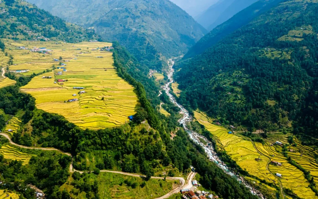
Where rain falls determines where Nepal’s rivers get their water, which determines hydropower siting, irrigation planning and landslide risk. Steep windward slopes with saturated soil are the country’s landslide factories, and DHM’s rainfall watch thresholds reflect that. Its warning system flags 60 mm in one hour, 80 mm in three hours, 100 mm in six, 120 mm in twelve and 140 mm in twenty-four as levels associated with landslide and high-flow risk.
Glaciers sit on the other side of the same equation. Accumulation depends on high-altitude snowfall, which orographic processes control. Our piece on glacial retreat around Nepal’s 8,000 m peaks covers what happens when that input shrinks while melt accelerates.
For travelers, the practical lesson is regional rather than national. Eastern Nepal and the central hills take the brunt of the monsoon. Trans-Himalayan districts stay walkable. Our eastern Nepal monsoon travel guide and the Dolpo monsoon trekking guide show both ends of that spectrum.
Frequently asked questions
When does the monsoon start and end in Nepal?
DHM gives a normal onset of 13 June and a normal withdrawal of 2 October. Actual dates vary by a fortnight or more in either direction, and withdrawal is progressive from west to east rather than national on a single day.
Which part of Nepal gets the most rain?
The ridges northwest of Pokhara, with Lumle the best documented station at above 5,000 mm annually. Wettest does not mean highest: these sites sit around 1,700 m, where the terrain first steepens.
Which part of Nepal is driest?
Mustang, Manang and Dolpa, north of the Annapurna and Dhaulagiri ranges. Published figures put annual rainfall under 200 mm, with under 150 mm during the monsoon itself.
Does it rain all day during the monsoon?
Rarely. Rainfall in the hills peaks in the late afternoon and again overnight, with mornings often clear. Research published in 2021 links that twice-daily pattern to heating and cooling of the valley slopes.
Is the rain shadow disappearing?
No, but it is measurably wetter than it was. Station records show Jomsom and Upper Mustang receiving more annual rainfall than two decades ago. Winter snowfall, which matters more for groundwater, has declined over the same period.
Is trekking possible during the monsoon?
Yes, in the right districts. Upper Mustang, Manang and Dolpa lie behind the barrier and stay comparatively dry. Leech-heavy middle hill routes and landslide-prone road sections are the real constraint, not rainfall totals alone.
Why do flights to Jomsom get canceled when it is sunny there?
Because the limiting factor is wind and cloud along the Kali Gandaki corridor, not conditions at the destination. Strong up-valley winds build through the morning, which is why flights are scheduled early.
How reliable are Nepal’s rainfall figures at high altitude?
Less reliable than lowland figures. Gauges are sparse above 3,000 m, snowfall is undercaught by standard instruments, and satellite estimates perform poorly over steep terrain. Treat high-altitude totals as approximations.
Nepal rewards readers who look at it region by region rather than as one climate. If this explainer was useful, save it for your trip planning, share it with whoever is arguing that monsoon means a washout, and keep exploring Nepal with NepalVue.


