



Few places in Nepal reward the effort quite like this one. Sitting at 4,919 meters, tucked into a glacial amphitheater behind the Annapurna massif, Tilicho is the kind of destination that makes serious trekkers rearrange their whole itinerary just to stand on its shore. If you are planning a high-altitude adventure and want something wilder than the standard base camp routes, the Tilicho Lake trek deserves a spot near the top of your list. Here is what you actually need to know before you go, starting with the parts most guidebooks gloss over.
Why the Tilicho Lake Trek Is Worth It
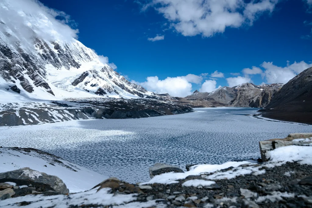
Tilicho is often called one of the highest lakes in the world, and while a handful of smaller tarns in Tibet and the Andes sit higher, none of them come with a trail this accessible or scenery this dramatic. The lake stretches nearly four kilometers across a barren, moon-like basin. On a clear morning the water turns a deep turquoise that looks almost fake in photos.
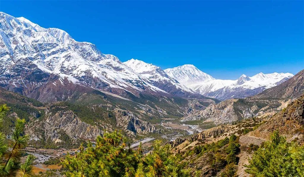
What most people do not realize is that Tilicho is not a standalone trek in the traditional sense. It branches off the classic Annapurna Circuit, usually as a two or three day side trip from the village of Manang. That means you get the full high-Himalaya experience: Buddhist villages, yak pastures, prayer-flag ridgelines, and a payoff most circuit trekkers never see because they skip it to save time.


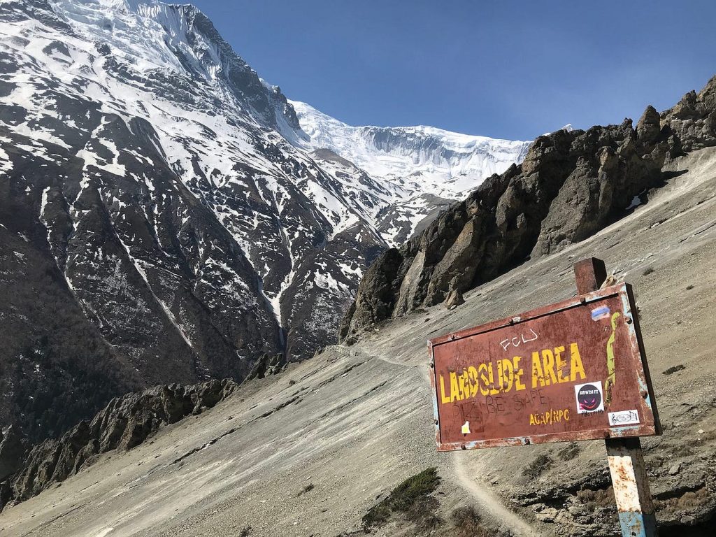
Here is the truth that few brochures admit. The section between Khangsar and Tilicho Base Camp runs across a notoriously loose, landslide-prone slope. It is not technical climbing, but it demands attention, an early start, and a healthy respect for falling rock.
The Route: Manang to Tilicho and Back
Most trekkers reach Manang (3,519 meters) as part of the Annapurna Circuit, following the Marsyangdi valley up through Chame and Pisang over several days. Manang is where the real acclimatization begins, and skipping rest days here is where a lot of people go wrong.
From Manang, the detour to Tilicho breaks down like this:
- Manang to Khangsar (3,750 meters): A short, gentle half-day walk through fields and past a small monastery. Roughly three to four hours.
- Khangsar to Tilicho Base Camp (4,150 meters): The infamous stretch. You cross scree slopes and eroded gullies where rockfall is a genuine concern. Start early, move steadily, and do not linger under loose sections. Four to five hours.
- Tilicho Base Camp to Tilicho Lake (4,919 meters) and back: A steep pre-dawn climb of around 800 vertical meters. You want to reach the lake before midday winds pick up. Budget six to seven hours round trip.
After the lake, most trekkers return to Manang and rejoin the circuit toward Thorong La Pass, or descend the way they came. Some experienced groups cross directly to Yak Kharka via a high route, but that option is weather-dependent and best attempted with a guide who knows the conditions.
How Difficult Is the Tilicho Lake Trek?
Call it moderately difficult, with a couple of genuinely demanding days. You do not need mountaineering skills or ropes. What you need is solid fitness, patience for altitude, and comfort walking on uneven, exposed terrain for six to eight hours at a stretch.
Altitude is the real challenge, not the trail itself. Going from Base Camp at 4,150 meters to the lake at nearly 4,920 meters in a single morning is a big jump. Acclimatization days in Manang are non-negotiable, and plenty of trekkers who breeze through the lower valleys still get headaches, nausea, or worse up here. Descend if symptoms get serious. No lake is worth pushing through acute mountain sickness.
One more honest note: accommodation and medical support thin out fast past Manang. Tilicho Base Camp has a couple of basic teahouses, and they fill up in peak season. Rooms are cold, food is simple, and there is no rescue clinic waiting nearby.
Permits You Need for the Tilicho Lake Trek
Because Tilicho sits inside the Annapurna Conservation Area, the permit situation is the same as the wider circuit. You will need two documents.
The Annapurna Conservation Area Permit (ACAP) costs NPR 3,000 for foreign nationals, roughly 25 US dollars, and NPR 1,000 for visitors from SAARC countries. It is issued by the National Trust for Nature Conservation. You can pick it up at the Nepal Tourism Board offices in Kathmandu or Pokhara, or at the ACAP counter in Besisahar.
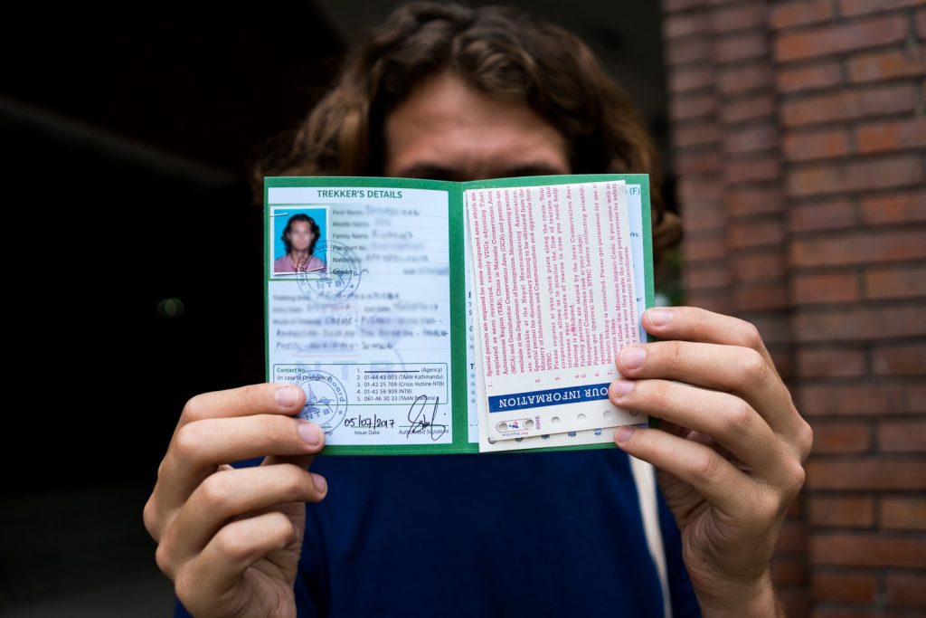
You will also want a TIMS card (Trekkers’ Information Management System). As of early 2025, the fee sits at around NPR 2,000 for individual foreign trekkers and NPR 1,000 for those trekking in an organized group, with lower rates for SAARC nationals. Rules around TIMS have shifted more than once in recent years, so confirm the current requirement before you travel. For a full breakdown of every permit and where to buy it, see our detailed Nepal trekking permits guide.
Carry printed copies plus a few passport photos. Checkpoints along the route will ask to see your paperwork, and a missing permit can get you turned back.
Best Time to Trek to Tilicho Lake
Two windows stand out. Autumn, from late September through November, delivers the clearest skies and the most stable weather of the year. Spring, from March to April, comes a close second, with warmer days and rhododendron forests in bloom lower down.
Winter is possible but brutal at these elevations. Snow can bury the Base Camp trail, temperatures at the lake drop well below freezing, and some teahouses close entirely. Monsoon season, June through August, brings slick trails and a much higher landslide risk on that already-sketchy Khangsar section, so most guides steer clients away from it.
If you can only pick one month, late October is hard to beat. Snow lingers on the high sections well into spring, so timing your window matters more here than on lower treks.
What to Pack and How to Prepare
Layering is everything up here. Daytime sun can feel hot at lower elevations, then the temperature plummets the moment clouds roll in or you gain altitude. Bring a proper down jacket, thermal base layers, a windproof shell, and gloves that actually work in the cold.
A few things worth prioritizing:
- Broken-in trekking boots with real ankle support for the scree slopes
- A warm sleeping bag rated to at least minus 10 Celsius, since teahouse blankets rarely cut it
- Sunglasses and strong sunscreen, because glare off snow and water at altitude is intense
- A basic altitude-sickness kit, and know how to use it
- Enough cash in Nepali rupees, as there are no ATMs past Chame
Training helps more than gear does. Spend the weeks before your trip on hills with a loaded pack. Manang makes an excellent acclimatization base, and it is worth reading up on the village before you arrive, which our Manang Valley guide covers in depth.
Guided or Independent?
You can technically trek much of the Annapurna region independently, but Tilicho is one place where a guide earns their fee. Someone who reads the landslide slope daily, knows when to move and when to wait, and can spot early altitude symptoms is genuinely worth having beside you. A guided Tilicho package generally starts around 850 US dollars, depending on group size and how many circuit days you add on.
Solo trekkers do complete it every season. If that is your plan, go slow, tell your teahouse hosts your route each morning, and never rush the Khangsar crossing to beat weather. Comparing this to other big treks? Our Annapurna vs Everest Base Camp comparison can help you decide where your time is best spent.
Frequently Asked Questions
How high is Tilicho Lake?
Tilicho Lake sits at 4,919 meters (about 16,138 feet). That elevation is what earns it a reputation as one of the highest lakes in the world with a walkable trail to its shore.
How many days does the Tilicho Lake trek take?
As a side trip from Manang, budget three to four extra days. Combined with the full Annapurna Circuit, the whole journey usually runs 14 to 18 days depending on your pace and acclimatization stops.
Do I need permits for Tilicho Lake?
Yes. You need the Annapurna Conservation Area Permit (around NPR 3,000 for foreigners) plus a TIMS card. Both are checked at points along the route, so carry printed copies.
Is the Tilicho Lake trek dangerous?
It is not technical, but the loose slope between Khangsar and Base Camp is genuinely landslide-prone, and altitude adds real risk. Start early, avoid the monsoon months, and descend if you develop altitude symptoms.
What is the best month to visit Tilicho Lake?
Late October tends to offer the clearest, most stable conditions. April is the strong spring alternative. Winter and monsoon both bring serious hazards and are best avoided by most trekkers.
Can beginners do the Tilicho Lake trek?
It is not ideal for a first-ever trek. You want prior multi-day hiking experience and good cardiovascular fitness before attempting the altitude and the exposed sections here.
How cold does it get at Tilicho Lake?
Even in peak season, nights at Base Camp routinely drop below freezing, and the lake itself can sit well under minus 10 Celsius at dawn. A four-season sleeping bag and a proper down layer are essential.
Are there teahouses on the Tilicho route?
Yes, but they are basic and limited. Tilicho Base Camp has a few simple lodges that fill quickly in autumn, so arriving early in the day improves your odds of getting a room.
Tilicho asks a lot of you, but it gives back more. Plan your permits, respect the altitude, and time your trip for a good weather window. For deeper conservation background on the region you will be walking through, the National Trust for Nature Conservation and the Nepal Tourism Board are both solid places to start.