



Most people assume the finest long trek in Nepal has to be Everest or Annapurna. The reality is different. A quieter loop around the world’s eighth-highest mountain hands you bigger scenery, thinner crowds, and a rawer taste of old Nepal that the famous trails lost a decade ago.
The Manaslu Circuit trek wraps around Mount Manaslu, which rises to 8,163 meters and dominates the skyline of the Gorkha district in west-central Nepal. You start low in subtropical river gorges, climb through Tibetan-influenced villages where prayer flags outnumber people, and finish by crossing a glacial pass over 5,000 meters. Roughly 177 kilometers of trail. Two weeks of walking. One of the last great Himalayan circuits that still feels genuinely wild.
Here is what most guides won’t tell you upfront: this trek is restricted. You cannot walk it alone, and the paperwork matters more than your fitness. Get that part right and the rest is one of the best decisions you will make in Nepal.


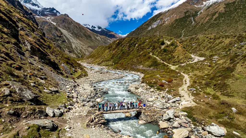
Why the Manaslu Circuit trek stands apart
Annapurna and Everest see tens of thousands of trekkers a year. Manaslu sees a fraction of that. Because the region only opened to foreigners in 1991 and still carries restricted-area status, the trail never developed the teahouse-every-hour density you find elsewhere.
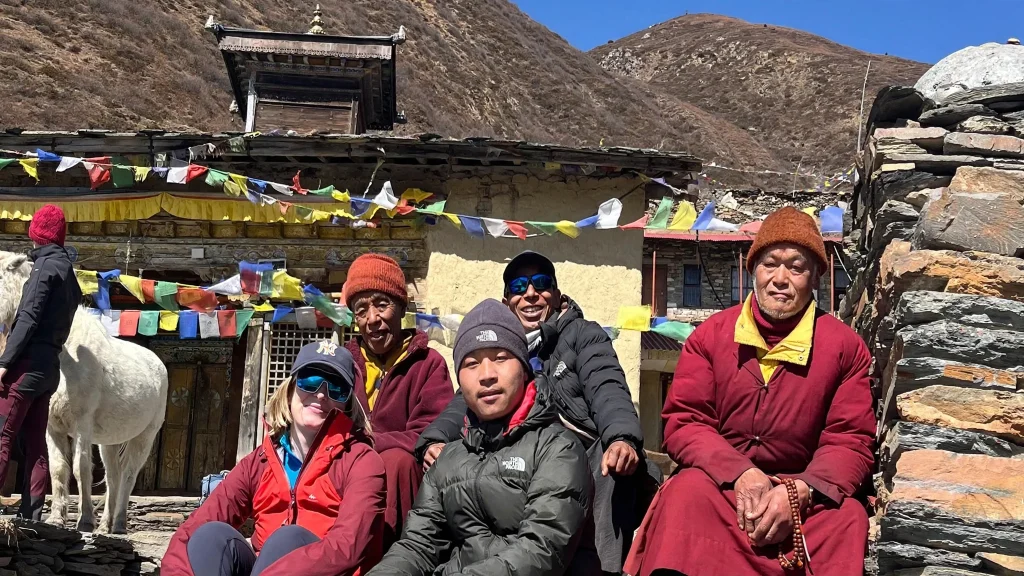
What you get instead is variety. Few treks in the country pack this much change into two weeks. You walk through rice terraces and waterfalls at 900 meters, then push up into pine and rhododendron forest, and eventually stand in a high desert of moraine and ice that looks more like Tibet than Nepal. Culturally, the shift is just as sharp. Lower villages are Hindu and Gurung. Higher up, in Samagaon and Samdo, the people are ethnically Tibetan, and the monasteries, chortens, and mani walls tell you the border is close.
The mountain views earn the effort. On a clear morning near Samagaon, Manaslu fills the sky. Add Himalchuli, Ngadi Chuli, and the peaks framing the Larkya La, and you have a wall of white that few photos do justice to.
The route, day by day
Getting to the trailhead
Reaching the start is half the adventure. From Kathmandu it is a long drive west toward Gorkha, then a rough road that has crept deeper into the valley over the years. Many groups now begin at Machha Khola or Soti Khola after seven to nine hours on the road. Bumpy, dusty, occasionally nerve-testing on the cliff-edge sections. Bring patience and motion-sickness tablets if you are prone.
From there the trail follows the Budhi Gandaki river upstream. Suspension bridges swing over turquoise water, and the gorge walls climb higher with every hour. Villages like Jagat mark the official entry to the restricted zone, where your permits get checked for the first time.
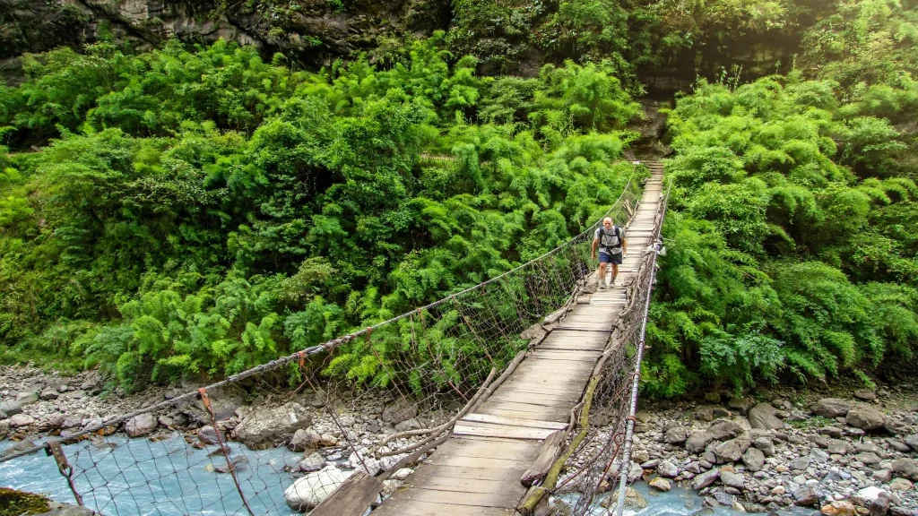
Up the Budhi Gandaki toward the high villages
Days three through six are a steady climb through the country’s shifting faces. You pass Deng, Namrung, and Lho, gaining altitude gradually, which is exactly what your body needs. At Lho, the first big head-on view of Manaslu tends to stop people mid-step. Samagaon, at around 3,500 meters, is the natural place to pause and acclimatize.
Do not skip that acclimatization day. Spend it climbing to Pungyen Gompa or up toward Manaslu Base Camp and Birendra Lake, then sleep low. This is where altitude sickness catches out the impatient, and where most serious problems on the route begin. Trekkers who rush through Samagaon are the ones who struggle at the pass.
Beyond Samagaon comes Samdo, the last real village, and then Dharmasala (also called Larkya Phedi), a bare cluster of stone huts that exists only to stage the pass crossing.
Crossing the Larkya La
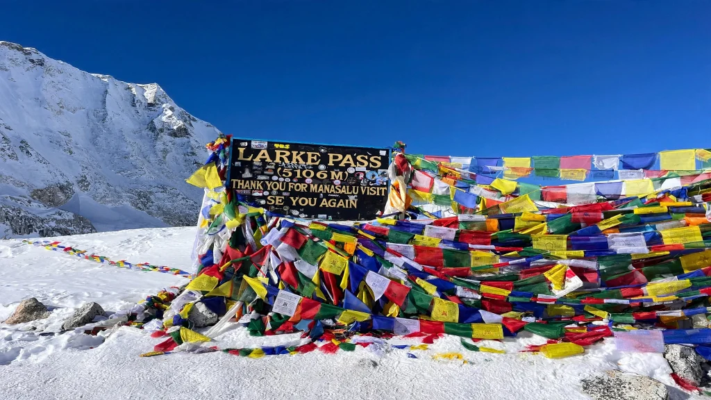
The big day starts in the dark, usually around 3 or 4 a.m. Larkya La sits at roughly 5,106 meters, and the climb to it is long, cold, and slow. Expect wind. Expect snow underfoot from October onward. Expect to feel every one of those meters of altitude.
Then the reward lands. From the top, a sweep of peaks opens across the horizon, and the long descent drops you toward Bimthang, a green valley that feels almost tropical after the ice. From Bimthang the trail unwinds through forest to Dharapani, where you join the classic Annapurna Circuit trail that leads up toward Manang Valley in one direction and down to Besisahar in the other. Most groups drive out from here.
Permits: why you cannot go solo
This is non-negotiable, and it is the single most common reason first-timers get tripped up. The Manaslu region is a restricted area, so you cannot trek it independently. You need a licensed guide, a minimum of two trekkers in a group, and your permits arranged through a registered Nepali trekking agency. Solo permits are not issued, full stop.
Three permits are involved:
- Manaslu Restricted Area Permit (MRAP): for September through November it runs about USD 100 per person for the first seven days, then roughly USD 15 per person for each additional day. From December through August it drops to around USD 75 for the first seven days plus about USD 10 per extra day.
- Manaslu Conservation Area Permit (MCAP): around USD 30 per person, the same year-round.
- Annapurna Conservation Area Permit (ACAP): around USD 30 per person, needed because the trail exits into the Annapurna region at Dharapani.
As of early 2025, a standard two-week trek in peak season worked out to somewhere near USD 260 to USD 270 per person in permit fees alone, plus small local checkpoint charges. Fees do get revised, so treat these as current estimates and confirm the latest figures with your agency before you pay. The official rules for restricted regions are published by Nepal’s Department of Immigration, and general trekking updates appear through the Nepal Tourism Board. If you want the full picture on how trekking permits work across the country, our Nepal trekking permits guide breaks it down step by step.
When to go
Autumn, from late September through November, is the classic window. Skies are clear, the mountain views are reliable, and the Larkya La is usually crossable without deep snow early in the season. Trails are busier then by Manaslu standards, though still empty compared with Annapurna.
Spring, roughly March through May, is the other strong choice. Rhododendrons bloom across the lower forests, temperatures are comfortable, and the passes reopen after winter. Days can be hazier than autumn, so plan for slightly softer distant views.
Winter is brutal at altitude and the pass often closes with snow. Monsoon, from June into September, brings leeches, landslides, and washed-out roads to the lower valley, though the trek connects logically with the sacred Tsum Valley for those who want a longer, culture-heavy route in the shoulder months.
How hard is it, really
Honest answer: moderately to seriously demanding. You do not need technical climbing skills, ropes, or crampons for a standard autumn crossing, but you do need real stamina. Days run five to seven hours on average, some longer, and the trail rarely stays flat for long. The Budhi Gandaki gorge throws relentless ups and downs at you before you even reach the high country.
Altitude is the true test. Larkya La is higher than Everest Base Camp, and the pass day is genuinely tough: an early start, thin air, and a long descent on tired legs. Anyone reasonably fit who trains with hills and hikes beforehand can do it. People who show up unprepared and rush the acclimatization are the ones who turn back.
What it costs
Because a guide and agency are mandatory, this is not a shoestring trek in the way some routes can be. A typical guided package covering permits, guide, porters, transport, and teahouse accommodation tends to land somewhere in the mid hundreds to low thousands of US dollars per person, depending on group size and season. Larger groups spread the fixed costs and pay less each.
On the trail, budget for extras. Charging devices, hot showers, Wi-Fi, and bottled or boiled water all cost money and get pricier the higher you climb. A liter of water that costs a little in Machha Khola can cost several times that near the pass. Carry cash in Nepali rupees, because there are no ATMs once you leave the road.
Packing and preparation
You will move through four distinct climate zones, so layering is everything. A short list of what actually matters:
- A warm down jacket rated for below-freezing nights near the pass
- Broken-in waterproof trekking boots, never brand new ones
- A four-season sleeping bag or a good liner to boost teahouse blankets
- Trekking poles, which save your knees on the long Bimthang descent
- A basic altitude plan, including optional Diamox after talking to a doctor
- Sun protection, since high-altitude glare is fierce even in cold weather
- Enough cash for the whole trek plus a buffer for emergencies
Train before you arrive. Stair climbing, weighted day hikes, and long walks in the months beforehand pay off more than any single piece of gear. Fitness is the cheapest insurance you can buy for this route.
Frequently asked questions
Can I do the Manaslu Circuit trek without a guide?
No. Manaslu is a restricted area, which means a licensed guide and a registered agency are legally required, and you need at least two trekkers in the group. Solo permits are not issued. If an agency offers you a solo Manaslu permit, walk away, because it is not legitimate.
How long does the trek take?
Most itineraries run 14 to 18 days including travel to and from the trailheads. A focused schedule can compress the walking to around 11 to 13 days, but building in at least one acclimatization day at Samagaon is strongly recommended and worth the extra time.
How high is the Larkya La pass?
The pass sits at roughly 5,106 meters, or about 16,752 feet. That makes it higher than Everest Base Camp, so proper acclimatization on the way up is essential to cross it safely.
How much do the permits cost?
As of early 2025, permit fees for a standard two-week autumn trek came to roughly USD 260 to 270 per person, combining the restricted area permit, the Manaslu conservation permit, and the Annapurna conservation permit. Costs are lower outside the September to November peak. Confirm current rates with your agency, as fees are periodically revised.
Is the Manaslu Circuit harder than Everest Base Camp?
In some ways, yes. The high point is slightly higher than EBC, the trail is more remote with less infrastructure, and the pass day is a serious effort. That remoteness is exactly what makes it rewarding for trekkers who want fewer crowds.
When is the best time to trek Manaslu?
Autumn, from late September to November, offers the clearest skies and most reliable pass conditions. Spring, from March to May, is the second-best window and adds blooming rhododendrons. Winter and the monsoon are best avoided for the full circuit.
Do I need previous trekking experience?
Prior multi-day trekking helps, but it is not strictly required. Good general fitness, some hill training beforehand, and a willingness to walk five to seven hours a day for two weeks matter more than a specific resume of past treks.
Is there mobile signal and Wi-Fi on the trail?
Patchy at best. Lower villages often have a usable mobile signal and some teahouses sell Wi-Fi access, but connectivity thins out and grows unreliable as you gain altitude. Plan to be largely offline for the higher sections, and tell people at home your rough schedule before you start.


