



You feel the wind before you see anything move. By late morning on the valley floor near Jomsom, grit starts ticking against your jacket, prayer flags above the terminal snap taut in one direction, and conversation becomes shouting. Dust lifts off the braided riverbed in long ochre streamers. This is the daily weather of the rain shadow Mustang occupies behind the Annapurna and Dhaulagiri massifs: a cold desert that receives less rain in a year than Pokhara receives in a fortnight, scoured every afternoon by one of the most reliable valley winds on earth. Understanding why requires three things: a mountain barrier, a heat engine, and a river older than the range it crosses.
The Rain Shadow, in Numbers
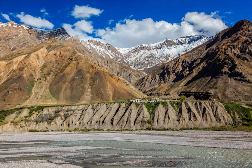
A rain shadow forms when moist air is forced up over a barrier, cools, and drops its moisture on the windward side. Air arriving on the far side has already been wrung out, and it warms as it descends, which lowers its relative humidity further. Mustang sits in the rain shadow of Dhaulagiri to the south and west and the Annapurna massif to the north and east.
Figures make the contrast concrete. Climate data compiled in WWF’s Climates of Nepal review records Jomsom at roughly 251 mm of annual rainfall, against about 3,301 mm at Pokhara, and more than 6,500 mm at Lumle on the Annapurna south flank. Barely 30 to 40 kilometers of mountain separate the wettest and driest places in Nepal.


| Station | Position | Annual rainfall |
|---|---|---|
| Lumle | Windward, Annapurna south flank | over 6,500 mm |
| Pokhara (918 m) | Windward, valley floor | approx. 3,301 mm (1965 to 1969 average) |
| Jomsom (approx. 2,600 m) | Leeward, Kali Gandaki valley | approx. 251 mm (1965 to 1969 average); under 260 mm in later records |
| Sources: WWF Nepal, Climates of Nepal; district climate summaries for Mustang. | ||
Monsoon contribution at Jomsom averaged about 133 mm across 1973 to 2000, which means more than half the year’s small total arrives in the summer rains and the rest comes as scattered winter precipitation, some of it snow. Year-to-year variability is large. Records note a single week in October 1968 delivering around 200 mm at Jomsom, well over half that year’s total. A long-term average is a poor guide to any particular year here.
Worth stating clearly: the rain shadow is not absolute. Monsoon moisture does push up the valley, cloud builds over Mustang in July and August, and the area is not immune to intense rainfall events. Dry on average is not the same as never wet.
The Wind: A Daily Heat Engine
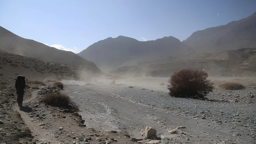
Mustang’s afternoon wind is the feature travelers remember, and it has a clean physical explanation. Valley and slope winds are thermally driven. Sunlight heats the valley floor and sidewalls faster than it heats air at the same altitude out over the lowlands. Warm air expands, pressure differences develop along the valley axis, and air flows up-valley to fill the gap. At night the process reverses weakly, producing a shallow drainage flow down-valley.
Potter and colleagues, writing in the Journal of Geophysical Research: Atmospheres in 2018, broke the acceleration terms down for a Himalayan valley and found the summer near-surface flow dominated by the local pressure gradient, advection and turbulent vertical mixing, with a clear diurnal cycle. Their study site was the Dudh Koshi basin rather than the Kali Gandaki, so apply the mechanism, not the specific numbers.
For the Kali Gandaki itself, the standard reference set is the three-part Diurnal Winds in the Himalayan Kali Gandaki Valley series published in Monthly Weather Review between 2000 and 2002, covering observations, modeling and remotely piloted aircraft soundings. Zängl and colleagues separately showed that topography and moisture together shape the pressure gradients driving the flow.
How Strong Does It Get
Ram P. Regmi and Sangeeta Maharjan, publishing in the Journal of Nepal Physical Society in 2017, used a meteorological station at Tangbe, about 6 km north of Kagbeni, together with numerical modeling. Over three days in mid-May 2012 the station recorded daily maximum wind speeds of roughly 16, 18 and 19 meters per second, with other high readings between 11 and 15 m/s. Peaks arrived in the afternoon, between 1400 and 1500 local time.
For scale, 19 m/s is about 68 km/h, in the range meteorologists call a strong gale. Earlier work cited in the same paper describes daytime up-valley winds of 15 to 20 m/s weakening in late afternoon and fading by evening, with a weak drainage flow forming late at night and sometimes persisting into late morning.
Three days of data is a thin basis for any general claim, and the authors say so. What the record supports is that very strong afternoon winds occur reliably in this valley during the pre-monsoon season, not a precise climatological mean.
Regmi and Maharjan also mapped mean wind power density across a 70 by 70 kilometer area and identified roughly 200 square kilometers, from Tukuche north to Lo Manthang, with good to outstanding wind energy potential, strongest around Jomsom and Kagbeni. Energy potential and engineering feasibility are different questions: turbine siting in a remote, seismically active, logistically difficult valley carries its own constraints.6
Why Flights Stop at Midday
Jomsom’s flights run in the early morning for exactly this reason. Once the thermal circulation spins up, turbulence and crosswinds in a narrow valley make small aircraft operations hazardous. Numerical studies of local flows over Jomsom airport have examined these aviation hazards directly. If your flight is scheduled for 7 a.m., that is not an inconvenience. It is the only reliable window. Practical planning around this is covered in our Jomsom and Kagbeni guide.
The Ground: A Collapsed Basin Full of Its Own Debris
Mustang’s landscape is not simply eroded mountain. Much of the Thakkhola area sits in a graben, a block of crust that dropped down between faults as the region extended east to west. Geologists know it as the Thakkhola-Mustang graben, and it is a well-studied example of late Cenozoic extension within the Higher Himalaya, associated with the South Tibetan fault system.
Extension here is counterintuitive. A range built by collision is, in its high interior, pulling apart. That subsidence created a basin, and the basin filled with sediment eroded off the surrounding highlands from the Miocene through the Quaternary. Those graben-fill sediments, poorly cemented gravels, sands, silts and lake deposits, are the soft material now being carved into the cliffs, pinnacles and badlands that define the Mustang skyline.
Above and around them sit Tethyan sedimentary rocks: marine sequences laid down on the floor of the Tethys Ocean before India collided with Asia, then lifted to altitude. Ammonite fossils weathering out of these beds along the Kali Gandaki are collected as shaligram, stones held sacred in Hindu practice, particularly in Vaishnava worship. Religious significance and marine geology are two true descriptions of the same object.
The River That Was There First
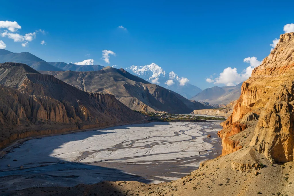
The Kali Gandaki crosses the entire Himalayan chain rather than flowing along it. Geologists generally interpret such rivers as antecedent, meaning the drainage was established before the mountains reached their present height and the river cut down fast enough to keep its course as the range rose. Rates and timing are debated, and the full history of the gorge is not settled.
The valley is often called the world’s deepest gorge. Measured as vertical drop from summit to riverbed, the claim holds: near Tukuche the river runs at about 2,520 m, roughly 5,571 m below the summit of Annapurna I. Measured as a narrow slot canyon in the usual sense of the word, it is not one. The number depends entirely on the definition, which is worth knowing before repeating it.
Erosion Without Much Rain
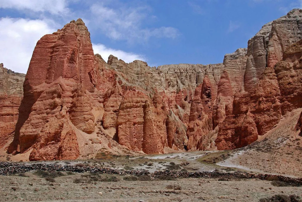
Deserts are not low-erosion environments. Mustang loses material through several processes working together:
- Fluvial incision. The Kali Gandaki and its tributaries cut downward through weak basin fill. Flow is strongly seasonal, concentrated in snowmelt and monsoon pulses.
- Debris flows and gully erosion. Rare intense rainfall on bare, unconsolidated sediment moves enormous volumes in hours. Research on the 2018 monsoon documented major geomorphic events in the Kali Gandaki valley.
- Mass wasting. Rockslides and gravitational slope deformations are aligned along the Kali Gandaki corridor across the Nepal Himalaya, reflecting both lithology and structure.
- Wind action. Sustained afternoon winds transport sand and silt, deflate loose surfaces, and abrade exposed rock. Sand sheets and dune forms occur locally on the valley floor.
- Frost weathering. Large daily temperature swings across the freezing point fracture rock mechanically, producing debris for the other processes to move.
Temperature ranges supply that last mechanism generously. Mustang records a mean minimum winter temperature near minus 2.7 °C and a mean maximum summer temperature near 23.1 °C, with large daily swings on top of seasonal ones.
How much of Mustang’s modern landscape is shaped by wind versus water remains a reasonable scientific question. Wind is the process you experience, which makes it easy to overweight. Most of the material actually leaving the catchment leaves in the river.
A Working Landscape, Not an Empty One
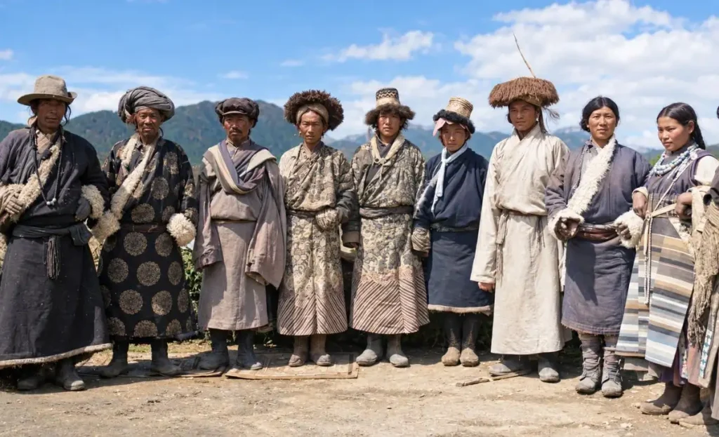
Mustang district covers roughly 3,573 square kilometers with an average elevation around 4,023 m, and recorded 14,452 people in the 2021 census. Population density is among the lowest in Nepal. Low density is not emptiness: Thakali, Loba and other communities have farmed, herded and traded in this valley for centuries, and irrigation channels fed by snowmelt support barley, buckwheat, and the orchards around Marpha described in our piece on the heritage apples of Marpha.
Aridity shapes that agriculture completely. Nothing grows here on rainfall alone. Every field depends on channel water routed from streams, and village water rights are long-standing institutional arrangements, not casual ones. Changes in snowpack and melt timing therefore matter to Mustang in a way they do not matter to a rain-fed hillside further south.
Frequently Asked Questions
Why is Mustang so dry when it sits in the Himalaya?
Because it lies behind the Annapurna and Dhaulagiri barrier. Monsoon air loses most of its moisture climbing the southern flank, and the descending air on the leeward side warms and dries further. Jomsom receives roughly 251 mm a year against more than 6,500 mm at Lumle, a short distance to the south.
When exactly does the wind pick up?
Typically by late morning, peaking in mid-afternoon. Measurements near Kagbeni recorded maxima between 1400 and 1500 local time. Mornings are usually calm, which is why trekkers and flights both start early.
How strong is the Kali Gandaki wind?
Measured daily maxima of roughly 16 to 19 m/s, about 58 to 68 km/h, were recorded near Kagbeni over three days in May 2012. Earlier studies describe typical daytime up-valley winds of 15 to 20 m/s. These are pre-monsoon figures and should not be read as a year-round average.
Is the Kali Gandaki really the world’s deepest gorge?
By the vertical difference between the riverbed and the summits above it, yes: about 5,571 m below Annapurna I near Tukuche. By the ordinary meaning of a narrow canyon, no. The claim is a measurement convention more than a description.
What are shaligram stones?
Ammonite fossils eroding out of Tethyan marine rocks along the Kali Gandaki. They are revered in Hindu practice, especially Vaishnava worship. Collection is regulated and in some places restricted, and travelers should check local rules before picking anything up.
Can Mustang’s wind be used for power?
Research by Regmi and Maharjan identified roughly 200 square kilometers between Tukuche and Lo Manthang with good to outstanding wind power density, strongest near Jomsom and Kagbeni. Resource potential is established. Project feasibility, including transmission and seismic and logistical constraints, is a separate matter.
Does it snow in Mustang?
Yes, mainly in winter, from westerly disturbances rather than the summer monsoon. Totals are modest by Himalayan standards, and snowmelt is an important water source for irrigation.
Is monsoon a good time to visit Mustang?
It is one of the few parts of Nepal that stays relatively dry in summer, which is why Upper Mustang attracts monsoon-season trekkers. Roads can still be cut by debris flows during intense rainfall, so build flexibility into any itinerary. See our Upper Mustang overland itinerary for route detail.
Keep Exploring
Mustang rewards slow attention. Follow the valley further north into the sky caves of Chhoser, or get the practical groundwork first with things to know before traveling to Mustang. Save this guide, share it with the person you are dragging up the valley, and follow NepalVue for more on the science behind Nepal’s landscapes.


