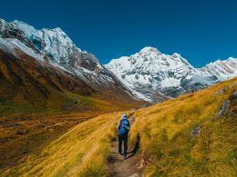



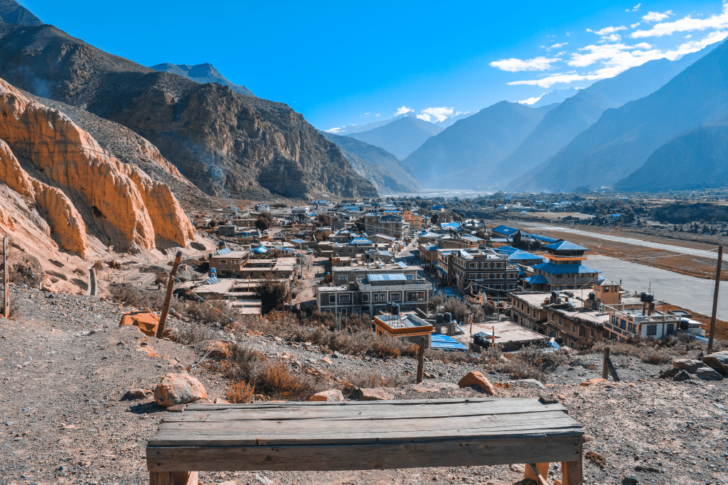
Most people assume the Himalayas are all green valleys and snow. Then they land in Jomsom, look around at the bare ochre cliffs, the wind-scoured riverbed, and the barley terraces clinging to a treeless slope, and they realize Nepal has a desert hiding behind its biggest mountains. This is the heart of the Jomsom Kagbeni corridor, the twin towns that open the door to Mustang. Two very different places sit barely 30 minutes apart by jeep, and together they give you the fastest, most rewarding taste of trans-Himalayan Nepal that exists.
Here’s what most guides won’t tell you up front: you do not need an expensive permit or a two-week trek to reach either town. You can fly in for breakfast. That accessibility is exactly why so many travelers underrate the region, and why the ones who go come back talking about it for years.
Why Jomsom Kagbeni Sits in a Rain Shadow
Geography does something strange here. The Kali Gandaki river carves the deepest gorge on Earth, running between two eight-thousand-meter giants, Dhaulagiri and Annapurna. Monsoon clouds pushing up from the south hit that wall of rock and drop their rain before they ever clear the peaks. What reaches Jomsom and Kagbeni is dry, thin, and startlingly clear.


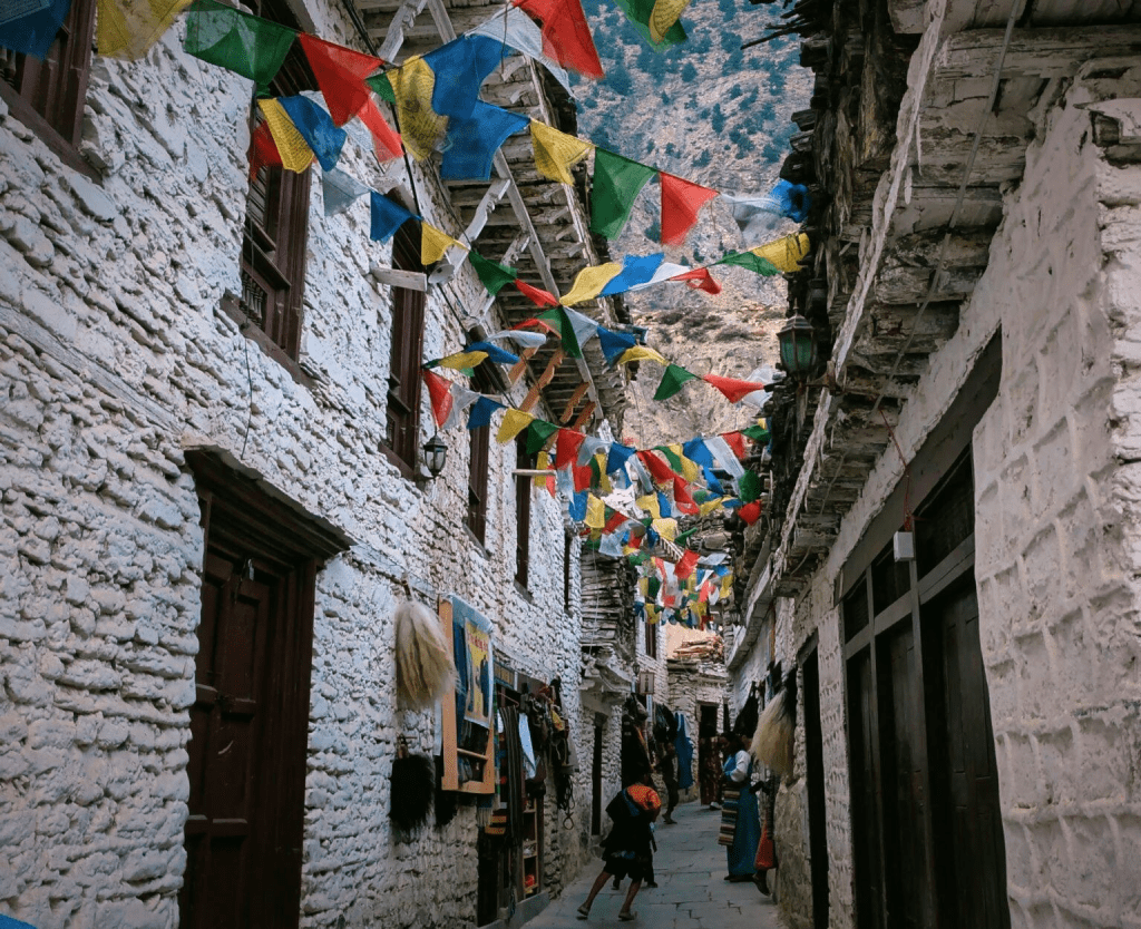
Jomsom sits at roughly 2,700 meters, close to 8,900 feet, framed by Nilgiri and the long white ridge of Dhaulagiri. It functions as the district headquarters, the transport hub, and the place where nearly every Mustang trip begins or ends. Kagbeni is a short hop north at about 2,800 meters, and it feels like stepping back six centuries. Narrow mud-brick lanes, prayer wheels worn smooth, a crumbling old fort. One town runs on jeeps and airplanes. The other still runs on barley and buckwheat.
Wind defines daily life in both. Cold air funnels up the gorge every morning, and by around 11 a.m. it turns into a steady gale that can knock you sideways on an exposed trail. Locals plan their whole day around it, and you should too.
How to Get There
Two realistic routes exist, and they suit very different kinds of travelers.
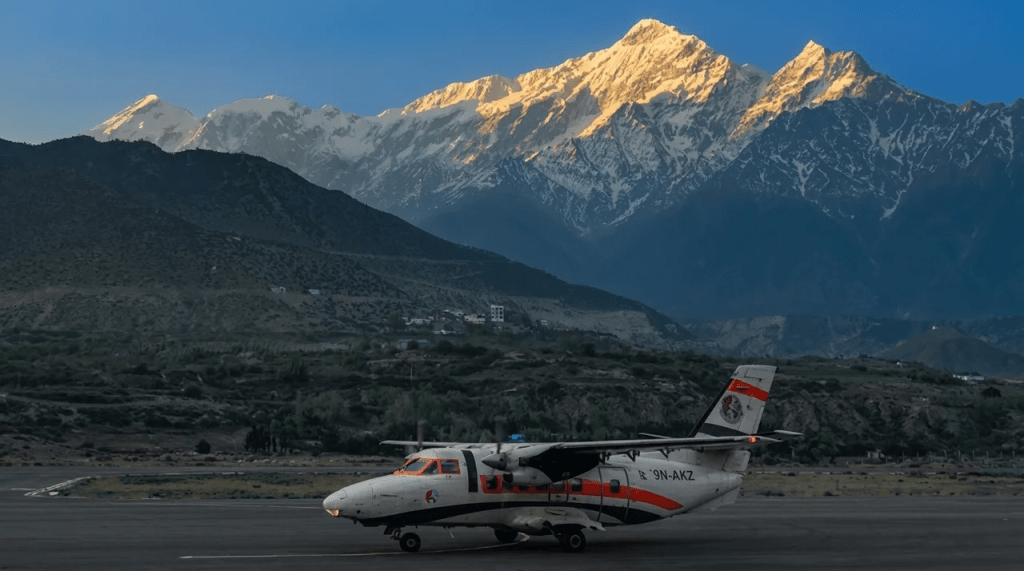
The fast option is the flight from Pokhara to Jomsom. It takes about 25 minutes, and as of early 2026 fares run roughly 100 to 125 US dollars per person one way. Planes are small, the airstrip is short, and flights leave at dawn for one simple reason: those afternoon winds make later departures dangerous. Delays and cancellations happen year-round, so never book a flight out on the same day you have an international connection. Build in a buffer day. People who ignore this rule are the ones stuck watching their trip unravel.
The overland option is a drive from Pokhara through Beni and Tatopani up the Kali Gandaki. Most of the road is now blacktopped, with only a rough stretch of 15 to 20 kilometers left unpaved between Beni and the upper valley as of 2026. A shared jeep is cheap and slow. A private jeep costs more but lets you stop at Marpha and its apple orchards along the way. Budget a full, bumpy day for the drive, sometimes two if the weather turns.
Whichever way you come, you first need to get to Pokhara. Flights from Kathmandu run around 100 to 110 US dollars for foreign travelers, or you can take the 6 to 8 hour tourist bus for a fraction of that. Our full Pokhara travel guide covers that leg in detail.
Permits You Actually Need
Confusion about permits stops more Mustang trips than bad weather does, so let’s be exact. Jomsom and Kagbeni both sit in Lower Mustang. Lower Mustang does not fall under the restricted-area rules. You need only the Annapurna Conservation Area Permit, known as ACAP.
As of early 2026, ACAP costs about 3,000 Nepali rupees, roughly 25 US dollars, for foreign nationals, and around 1,000 rupees for citizens of SAARC countries. You can buy it at the Nepal Tourism Board office in Kathmandu or the ACAP counter in Pokhara Lakeside. Bring a passport photo and a copy of your passport.
Here is the line that trips people up. The moment you travel north of Kagbeni into Upper Mustang, everything changes. Upper Mustang is a restricted area, and the permit there costs 50 US dollars per person per day. That fee used to require a ten-day minimum, but the rules have loosened, and shorter permits are now issued. If your plan stops at Kagbeni and Muktinath, ACAP alone is enough.
What to Do in Jomsom
Jomsom is not a place you linger for its charm. It is functional, dusty, and busy with trekkers and jeeps. Still, give it an afternoon.
The town is the cultural home of the Thakali people, and their food is reason enough to stop. A proper Thakali dal bhat here, with buckwheat, local greens, and a fiery timur pepper pickle, beats almost anything you will eat on the trail. There is a small Mountaineering Museum worth a quick visit for its displays on Thak Khola culture.
Use Jomsom as a base for short day walks. A gentle stroll up to Old Jomsom or across the river to Thini village gives you big views without the crowds. Sunrise on Nilgiri from the edge of town, when the wind is still asleep, is quietly spectacular.
What to Do in Kagbeni
Kagbeni is where the region earns its reputation. Sitting at the meeting point of the Kali Gandaki and the Jhong rivers, it has guarded the trade route to Tibet since at least the eighth century. Salt caravans once passed through here. The medieval bones of the place are still standing.
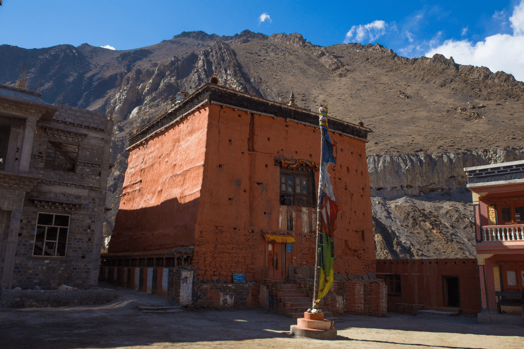
The centerpiece is Kag Chode Thupten Samphel Ling monastery, founded in 1429 and painted the deep red-ochre that marks Mustang’s gompas. It still functions as a monastic school, and if you visit respectfully in the morning you may hear young monks at their lessons. Wander the old village afterward. Get lost in the alleys on purpose. Find the ruined dzong, the ancient fort that once controlled the valley.
A few more things worth your time in Kagbeni:
- Hunt for shaligrams on the riverbank, the black ammonite fossils that Hindus consider sacred forms of Vishnu.
- Hike across to Tiri village for a quieter, even older settlement with almost no other tourists.
- Stop for an apple brandy or fresh apple cider, both local specialties born from Mustang’s orchards.
- Snap a photo of the famously named “Yac Donald’s” lodge, a cheeky local joke that has become a Kagbeni landmark.
Kagbeni is also the literal checkpoint for Upper Mustang. Stand at the police post on the north edge of town and you are looking straight up the trail toward Lo Manthang, the walled capital of the old forbidden kingdom. If that view pulls at you, our Upper Mustang overland itinerary maps out the whole route.
Best Time to Visit Jomsom and Kagbeni
Because of the rain shadow, this region breaks the usual Nepal rules. Spring, from March through May, brings dry skies, apple blossoms, and comfortable daytime temperatures. Autumn, September through November, is the classic window, with stable weather and long, clear mountain views.
Winter is cold, and nights drop well below freezing, but skies in December and January are often crystalline and crowds thin out. Then there is monsoon. While the rest of Nepal drowns from June to August, Jomsom and Kagbeni stay largely dry, which makes them one of the few genuinely good summer trekking destinations in the country.
Whatever month you choose, remember the wind. Trek in the morning, arrive at your next village by early afternoon, and let the gale howl while you drink tea indoors.
Where to Stay and What It Costs
Both towns run on teahouses and small lodges rather than hotels. In Jomsom you will find comfortable guesthouses with hot showers and wi-fi, plus simpler trekker lodges. A basic room runs cheap, often just a few hundred rupees, with the expectation that you eat there.
Kagbeni skews more atmospheric, with restored traditional houses turned into cozy lodges. Expect to pay a little more for the character and the views. Food costs more than in Kathmandu, because everything except apples and barley has to be hauled in by jeep. Carry enough cash. ATMs are unreliable, and cards are rarely accepted.
A Sample Short Itinerary
If you want the region without a long trek, four days does it comfortably. Fly Pokhara to Jomsom on day one and explore town. Jeep or walk to Kagbeni on day two and soak in the old village. Day-trip up toward Muktinath, the sacred temple loved by both Hindus and Buddhists, on day three. Fly out on day four, with a buffer day built in. That mix of comfort and depth is why this corner keeps drawing travelers who want the trans-Himalayan feel without the full Mustang expedition.
Practical Tips Before You Go
- Acclimatize sensibly. Kagbeni sits near 2,800 meters, and if you push up to Muktinath you cross 3,700 meters, high enough to feel it.
- Pack for wind and sun, not just cold. Sunglasses, lip balm, and a buff for the dust are non-negotiable.
- Book flights for the earliest slot and keep expectations loose. Weather wins here.
- Respect the monasteries. Ask before photographing monks or interiors.
- Carry plenty of cash in rupees.
Frequently Asked Questions
Do I need a special permit for Jomsom and Kagbeni?
No. Both towns are in Lower Mustang and require only the Annapurna Conservation Area Permit (ACAP), which costs about 3,000 rupees, roughly 25 US dollars, for foreign travelers as of early 2026. The expensive 50-dollar-per-day restricted permit only applies if you travel north of Kagbeni into Upper Mustang.
How do I get from Pokhara to Jomsom?
You can fly, which takes about 25 minutes and costs roughly 100 to 125 US dollars one way, or drive by jeep, which takes a full day. Flights leave early to beat the strong afternoon winds and are frequently delayed.
How far apart are Jomsom and Kagbeni?
They are close, about 30 to 40 minutes apart by jeep, or a few hours on foot. Many visitors base themselves in one and day-trip to the other.
Is it safe to visit during the monsoon?
Yes, and it is one of the better options. Both towns sit in a rain shadow behind Dhaulagiri and Annapurna, so they stay largely dry from June to August while the rest of Nepal floods. The main risk is road delays on the drive up, not rain in the valley itself.
What is the altitude, and will I get altitude sickness?
Jomsom is around 2,700 meters and Kagbeni about 2,800 meters, low enough that most people feel fine. If you continue up to Muktinath at roughly 3,700 meters, ascend slowly and watch for headaches or nausea.
What food is famous in this region?
Thakali dal bhat is the local star, a hearty set meal with buckwheat, greens, and timur pepper pickle. Mustang is also apple country, so try the fresh apple cider and apple brandy produced in nearby Marpha.
Can I reach Upper Mustang from Kagbeni?
Yes. Kagbeni is the official checkpoint and starting point for Upper Mustang. You will need the restricted-area permit and, in most cases, a licensed guide to continue north toward Lo Manthang.
How many days should I plan for Jomsom and Kagbeni?
A comfortable trip takes three to four days, including a buffer day for flight delays. That is enough to explore both towns and take a day trip toward Muktinath without rushing.
Jomsom and Kagbeni reward travelers who slow down and read the landscape. Come for the accessibility, stay for the wind-carved cliffs and that first jolt of surprise when you realize the Himalayas hide a desert. For deeper planning, resources like the Nepal Tourism Board and the Annapurna Conservation Area Project are the most reliable places to check current fees and travel updates before you set out.