



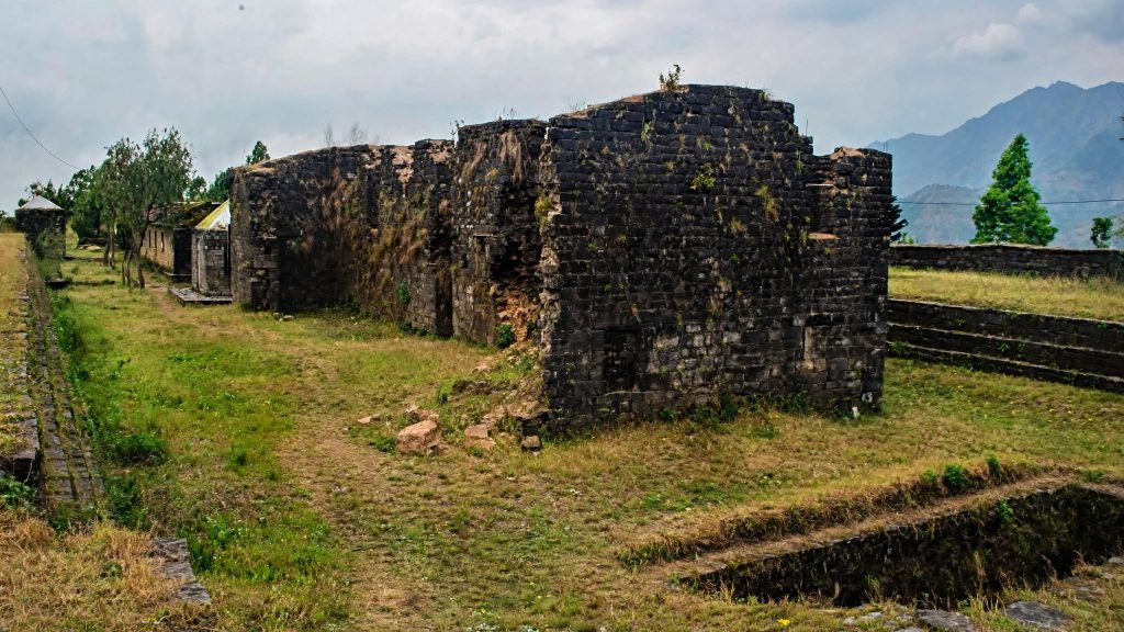
On a January morning in 2026, a crowd gathered at Makwanpurgadhi, about 17 km north of Hetauda, for a victory festival marking a battle fought there in 1762. Very little of the fort itself survives. A broken perimeter wall, a dry defensive ditch and scattered foundations are most of what remains of a stronghold that once controlled the main route between the Gangetic plain and the Kathmandu Valley.
This article explains who the Sen rulers were, why they built along the Churia ridge, what archaeology can and cannot tell us about these sites, and what condition the ruins are in now.
Who the Sen rulers were
The fortresses of the Sen dynasty belong to a period of Nepali history that sits awkwardly between better-known eras. Malla Kathmandu Valley gets the architectural attention. Shah unification gets the narrative. Sen kingdoms of the central and eastern lowlands and inner hills occupied the two centuries in between, and their physical remains are correspondingly neglected.


Sen rulers claimed descent from the Sena dynasty of Bengal. Mukunda Sen, treated as the founder of the line in Nepal, is recorded as settling at Rupanagar in what is now Saptari district before expanding into the Makwanpur region. Standard references date the establishment of the Makwanpur kingdom to 1518, though early chronology in this period rests on chronicles and later genealogies rather than contemporaneous records, and dates vary between sources.
Expansion ran westward toward Palpa and then into Rajapur, Tanahun, Pyuthan, Gulmi and other hill districts. Until 1675 the Makwanpur kingdom paid tribute to the Rajas of Darbhanga, a detail that says a good deal about where its political gravity lay.
The fragmentation
Sen power did not fall in one piece. From the reign of Mukunda Sen II, the kingdom split into smaller autonomous principalities held by family members. Palpa in the west, Makwanpur in the center, and Chaudandi and Vijayapur in the east emerged as separate states. Chaudandi covered much of present-day Madhesh Province and part of southeastern Bagmati; Vijayapur covered the territory of present-day Koshi Province.
Vijayapur’s history is more complicated than a simple Sen story. According to research published in Voice of History, the state and its fort were founded by a Kotche king, Sangla Ing, and only later came under Sen control when Lohang Sen took it following intervention by Mukunda Sen’s forces. The same account dates Sen rule at Vijayapur from 1553 to 1775 and records Kirata chieftains serving as ministers, titled Dewan or Roy, on six-month rotation. Kirata communities, including Limbu and Rai, were not subjects of a foreign administration in any simple sense; they were part of how it functioned.
Why the Churia ridge
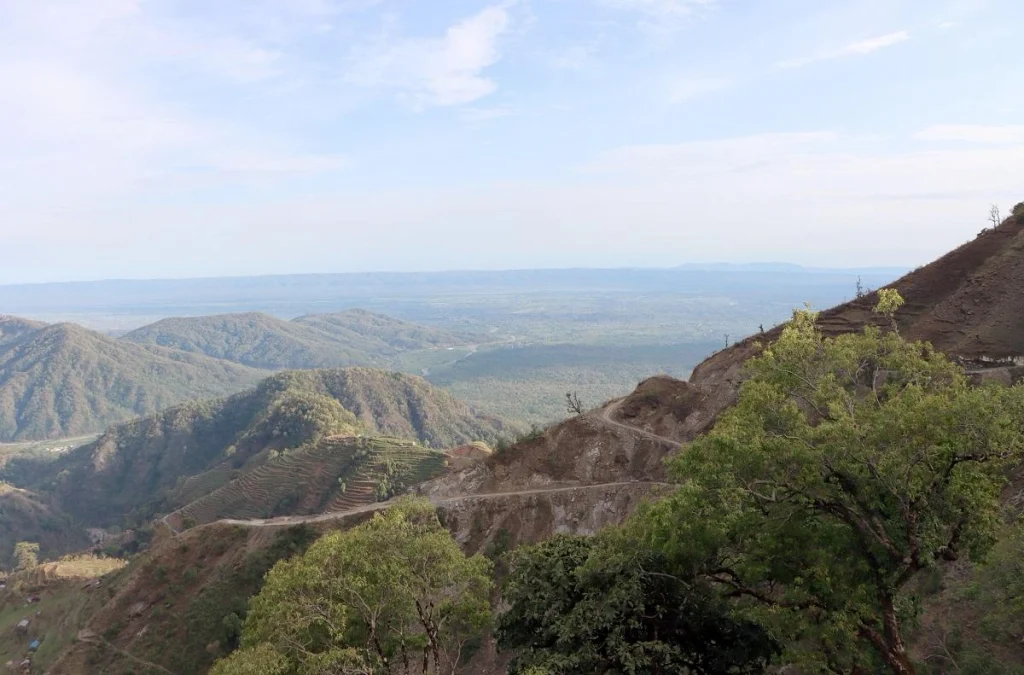
Fort placement was not sentimental. Churia, also called the Siwalik range, is the first line of folded hills rising from the plains, averaging around 1,000 m in elevation and running more than 1,600 km from the Tista eastward through Nepal into northwestern India and Pakistan. It began rising roughly 40 million years ago as the Himalaya were pushed up, and it is built of soft, easily eroded sediments.
Three things made it strategically useful.
- Chokepoints. Rivers cut through the Churia at a limited number of gorges. Control a gorge and you control a trade route.
- Elevation without isolation. Ridges gave defensive height and sightlines over the plains while remaining close to the farmland and markets of the Terai.
- The malaria barrier. Terai forests at the foot of the Churia were seasonally malarial until eradication campaigns from the 1950s. Armies from the plains could not easily campaign there for much of the year, which gave hill-based rulers a defensive asset nothing had to be built to provide.
Dun valleys behind the Churia, including the Chitwan and Deukhuri duns, provided agricultural land sheltered behind the ridge. Where the range splits into two parallel ridges, as it does around Dang and Deukhuri, those inner valleys are substantial.
What the sites are like
Makwanpurgadhi
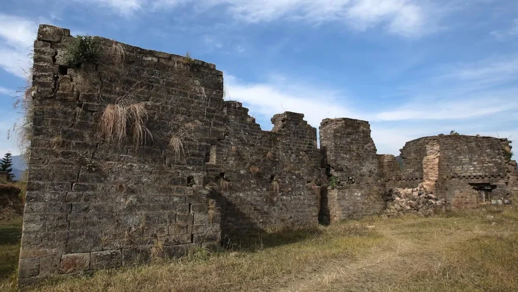
Makwanpurgadhi is the best-known of the Sen forts and the most visited. It sits about 17 km north of Hetauda in Makwanpur district. Construction is attributed to Tula Sen, a Sen king, though a firm construction date is not established in accessible sources. Reported dimensions give a surrounding wall of about 25 feet high and 7 feet thick, with a defensive ditch roughly 10 feet deep.
Condition is poor. Accounts record the loss of several monuments on the site, the theft of a sacred image known as Bangashagopal, and the disappearance of the Jungey Darbar palace structure. No garrison function has existed for centuries, and the site has not had the sustained conservation investment given to Kathmandu Valley monuments.
Makwanpur fell to Prithvi Narayan Shah’s forces at the Battle of Makwanpur in 1762, a decisive step in the Gorkha conquest of the Valley approaches. Casualty figures reported for that engagement, 60 Gorkhali and 400 Makwanpur dead, come from chronicle-based accounts and should be treated as traditional rather than verified.
Note also that at least one reference gives 1819 for Gorkha annexation of Makwanpur, which conflicts with the 1762 battle date. Discrepancies of this kind are common in the period’s sources.
The Saptari ruins
Further east, in Saptari district, sit the remains associated with the earliest Sen presence in Nepal, including the Chandrabhoga Gadhi site and ruins at Kanchha Khoriya. Documentation of these is thinner. What survives is largely brick and earthwork rather than standing architecture, and interpretation depends heavily on surface survey rather than systematic excavation.
Palpa and Tansen
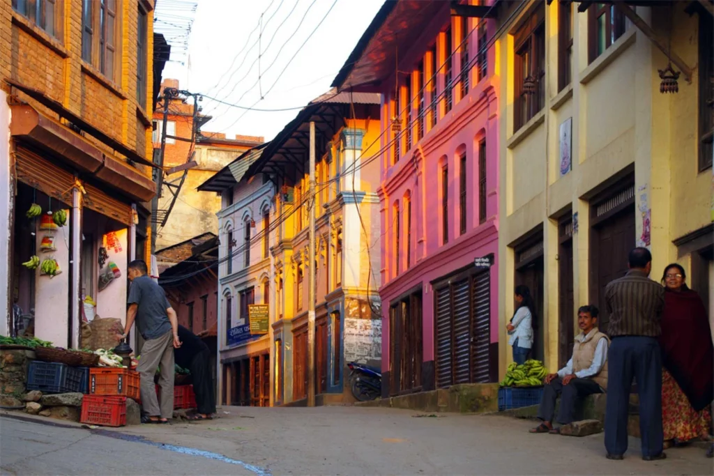
Palpa’s Sen kingdom was once considerably larger before Argha, Khanchi and Gulmi broke away as independent states. Its end was political rather than military: Prime Minister Bhimsen Thapa ordered the execution of King Prithivipal Sen, and Palpa was absorbed into the Kingdom of Nepal. Commonly cited date for the annexation is 1806, though the source consulted here does not give a year. Tansen, the hill town that served as Palpa’s center, retains Newar-built commercial architecture from later periods rather than Sen-era fortification, and is covered in our Tansen Palpa hill station guide.
What archaeology has, and has not, established
Here is where honesty matters more than narrative.
| Question | State of the evidence |
|---|---|
| Who built Makwanpurgadhi | Attributed to Tula Sen in reference accounts; not independently confirmed by excavation |
| Construction dates of the forts | Not established for most sites; chronicle-based estimates only |
| Fort dimensions | Measured figures reported for Makwanpurgadhi’s wall and ditch; other sites largely unmeasured in published sources |
| Building sequence and phases | Unknown without stratigraphic excavation |
| Full inventory of Sen-period gadhis | Incomplete; many earthwork sites are unsurveyed |
| Battle of Makwanpur, 1762 | Date well attested in standard histories; casualty figures traditional |
Nepal’s Department of Archaeology is the responsible authority for protected monuments, but resources are concentrated on World Heritage properties in the Kathmandu Valley and Lumbini. Churia-ridge earthworks sit well down the priority list. Several gadhi sites across the Terai and inner hills have had renovation work driven by local municipalities and provincial governments rather than national archaeological programs, and renovation is not the same as excavation. Rebuilding a wall can destroy the stratigraphy that would have dated it.
Where a site is also a living religious or festival space, as Makwanpurgadhi is during its annual victory observance, conservation decisions involve more than archaeology. Communities using a site have their own claims on how it is treated.-
How these forts were built
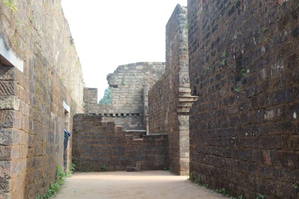
Absence of excavation makes construction technique partly a matter of inference, but the surviving fabric tells you something.
Sen-period gadhis along the Churia were not castles in the European sense. Typical construction combined an earthen rampart cut from the ridge itself with a stone or brick facing on the more exposed approaches, and a ditch dug on the vulnerable side. Makwanpurgadhi’s reported wall of roughly 25 feet high and 7 feet thick, paired with a ditch about 10 feet deep, fits that pattern. Materials came from immediately nearby, which is why Churia-ridge sites use local stone and fired brick while hill forts further north rely more heavily on dry stone.
Soft Siwalik geology cuts both ways. Ridges are easy to shape into defensive earthworks, and equally easy for monsoon rain to erode once maintenance stops. Several sites that appear on historical lists as substantial fortifications now register only as vegetation-covered mounds, which is one reason a complete inventory of Sen-period gadhis does not exist.
Internal arrangements are poorly documented. Chronicle references to a palace structure at Makwanpurgadhi, the Jungey Darbar, indicate that these were administrative and residential centers rather than purely military posts, but the layout of residential, storage and religious buildings inside the walls is unknown at every Sen site in Nepal without excavation.
Why they fell quickly
Gorkha campaigns of the 1760s overran Sen strongholds within years, and the forts themselves were not the main reason.
Fragmentation was. By the mid-eighteenth century, the Sen inheritance had broken into separate states with separate interests, and Palpa, Makwanpur, Chaudandi and Vijayapur did not combine against the Gorkha advance. Prithvi Narayan Shah’s forces could engage them in sequence. Makwanpur’s defeat in 1762 also opened the southern approach to the Kathmandu Valley, which fell in 1768 and 1769.
A second factor was the nature of the fortifications. Ridge-top earthworks suited the warfare of their region and period: raiding, route control and taxation of trade. They were not designed against a sustained, well-organized campaign of conquest by a state that had spent a generation preparing one.
Visiting, and doing it responsibly
Makwanpurgadhi is reachable from Hetauda by road, and Hetauda is a straightforward journey from Kathmandu. Expect an archaeological site rather than a monument: little interpretation, variable path conditions, and few facilities. Saptari sites require local guidance and are not set up for casual visitors.
Basic practice applies at any unprotected site. Do not remove brick, stone or sherds. Do not climb on walls that are already unstable. Where a site is in active ritual use, follow whatever the people present are doing. For context on how Nepal manages its better-resourced heritage, see our overview of UNESCO World Heritage sites in Nepal, our guide to the historic settlement of Kirtipur, and our Lumbini travel guide.
Frequently asked questions
Who were the Sen kings of Nepal?
Rulers of several lowland and inner-hill kingdoms between roughly the sixteenth and late eighteenth centuries, claiming descent from Bengal’s Sena dynasty. Their states included Makwanpur, Palpa, Chaudandi and Vijayapur.
What does “gadhi” mean?
Gadhi is the Nepali term for a fort or fortified stronghold. Many place names across the Terai and inner hills, including Makwanpurgadhi and Chandrabhoga Gadhi, preserve the word.
When did the Sen kingdoms end?
Makwanpur fell to Prithvi Narayan Shah in 1762 at the Battle of Makwanpur. Vijayapur was absorbed during the eastward Gorkha campaigns, with one account dating Sen rule there to 1775. Palpa ended with the execution of Prithivipal Sen on Bhimsen Thapa’s order, commonly dated to 1806.
Can you visit Makwanpurgadhi?
Yes. It lies about 17 km north of Hetauda and is accessible by road. Standing remains are limited, so visit for the setting and the history rather than for architecture.
Why were the forts built on the Churia rather than in the plains?
Height, sightlines, control of river gorges through the range, and the practical defense offered by seasonally malarial Terai forest at the foot of the hills. Dun valleys behind the ridge also provided farmland.
Have the sites been excavated?
Not systematically, in most cases. Published knowledge relies largely on chronicles, surface remains and local documentation. Some sites have received renovation work from local or provincial authorities, which is not the same as archaeological investigation.
Were Kirata communities subjects of the Sen rulers?
The relationship was more layered than subjugation. At Vijayapur, Kirata chieftains held ministerial office as Dewan or Roy on rotation, and they retained local privileges after the Gorkha conquest. Arrangements differed between states and periods.
Is there anything left to see at the Saptari sites?
Mostly brick foundations and earthworks rather than standing buildings. Finding and interpreting them realistically requires local guidance.
Before you go
Ruins without interpretation panels are easy to walk past. Knowing what you are looking at changes the visit entirely. Save this guide if you are heading toward Hetauda or the eastern Terai, share it with anyone interested in the parts of Nepali history that sit outside the Kathmandu Valley, and follow NepalVue for more on the country’s less-documented heritage.


